canoe

Blog

Killick Creek (estuary) at Crescent Head


No Comments


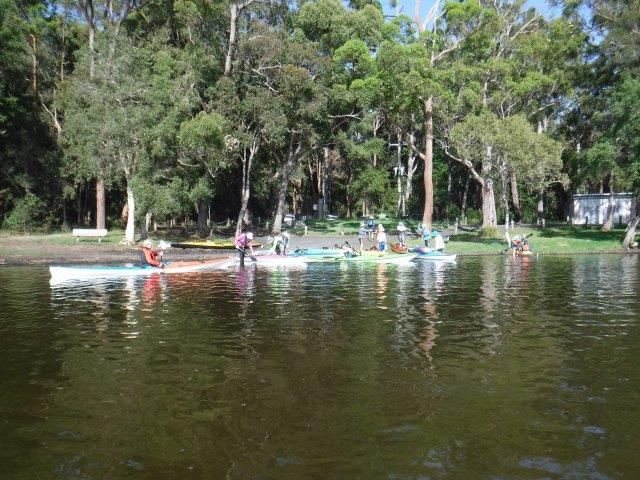
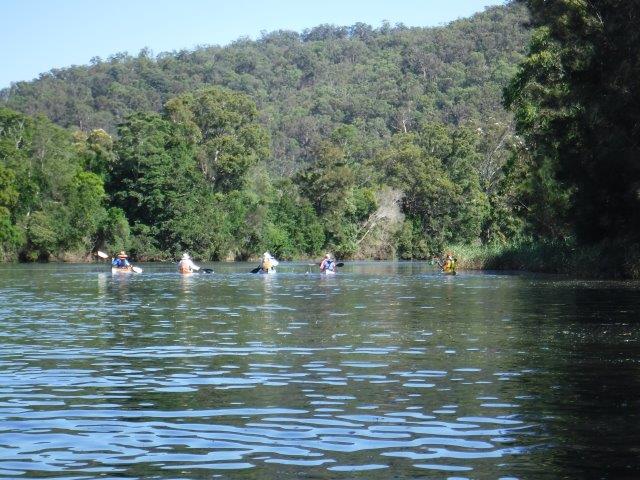
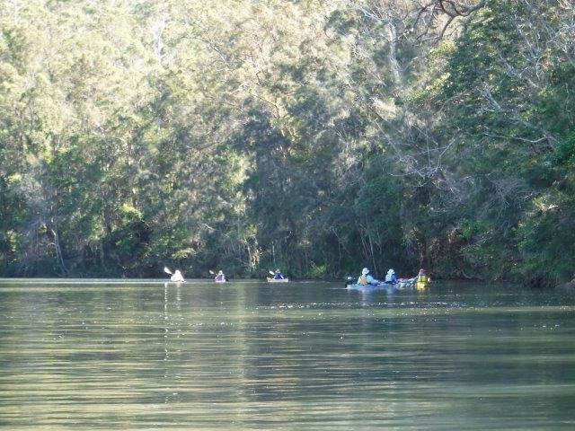
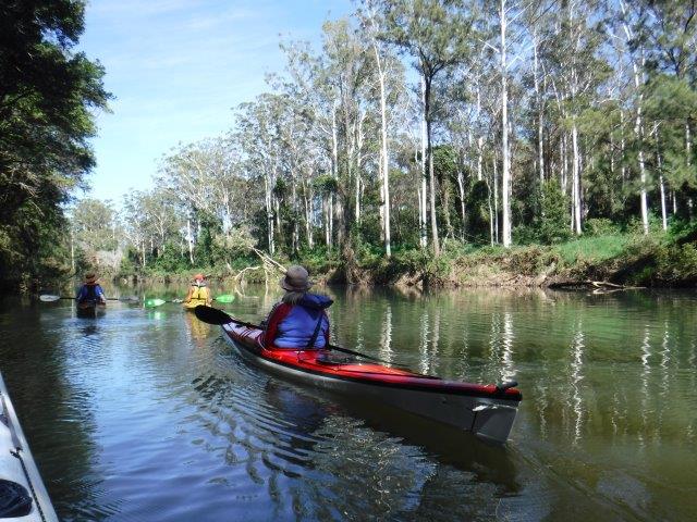
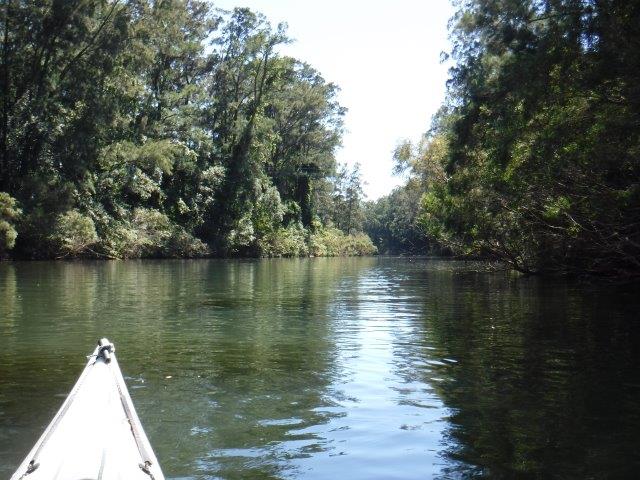
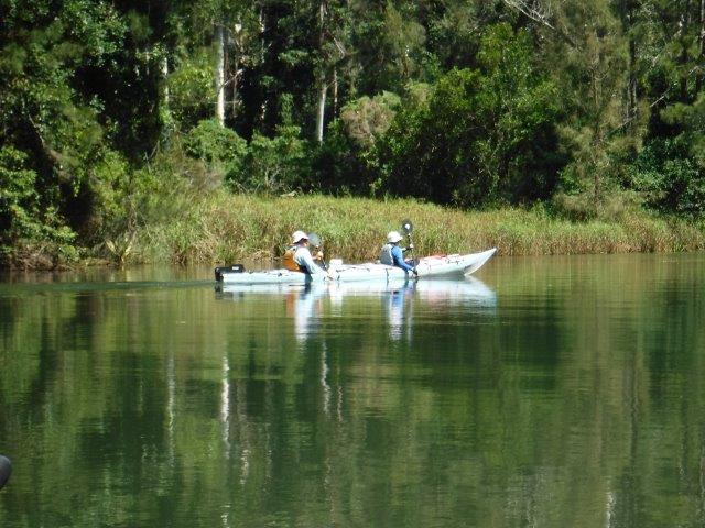
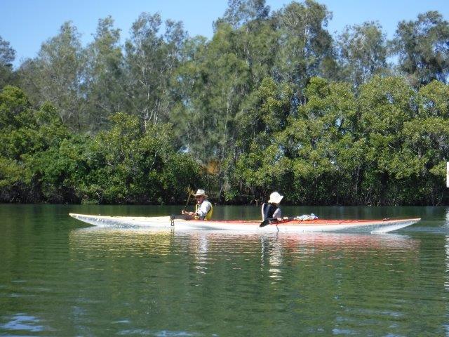
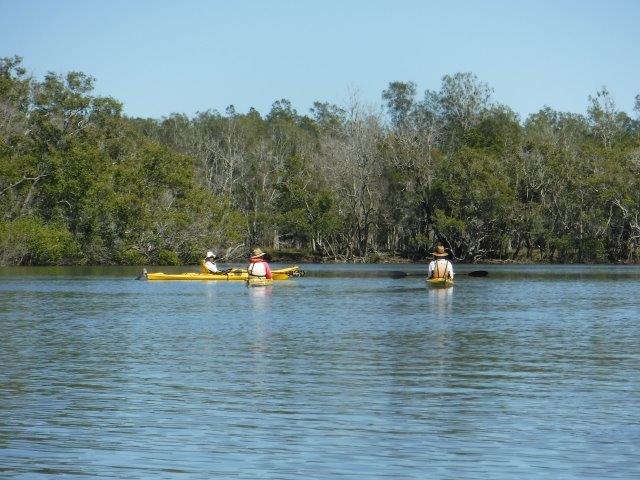
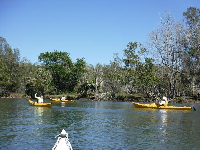
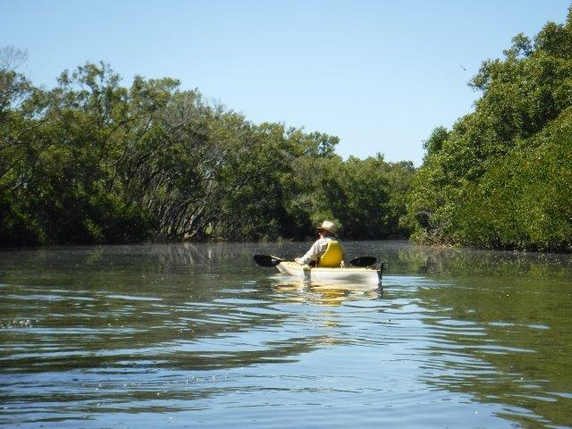
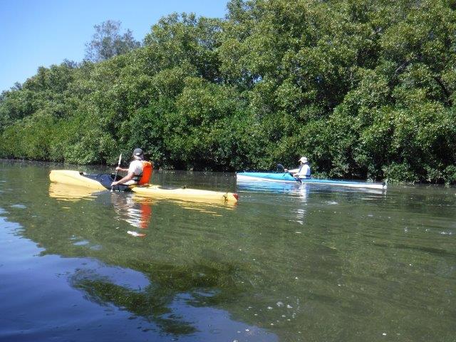
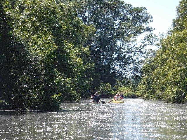
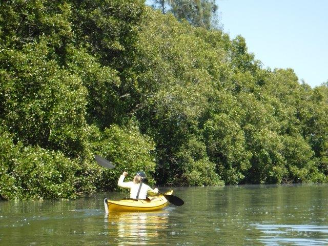
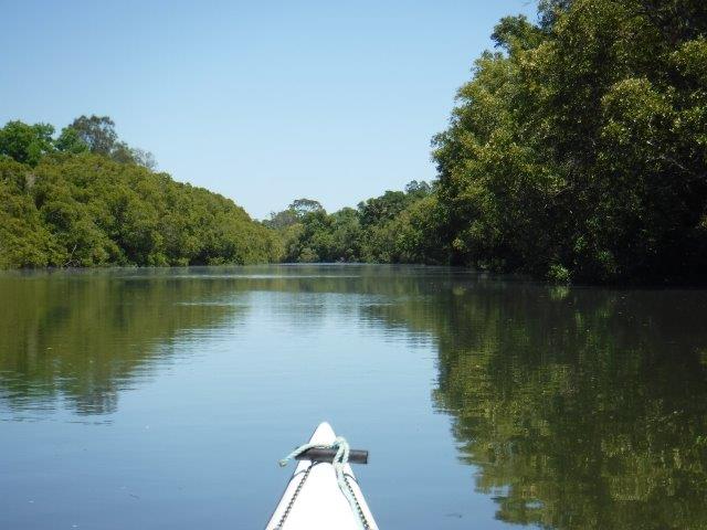
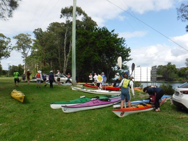
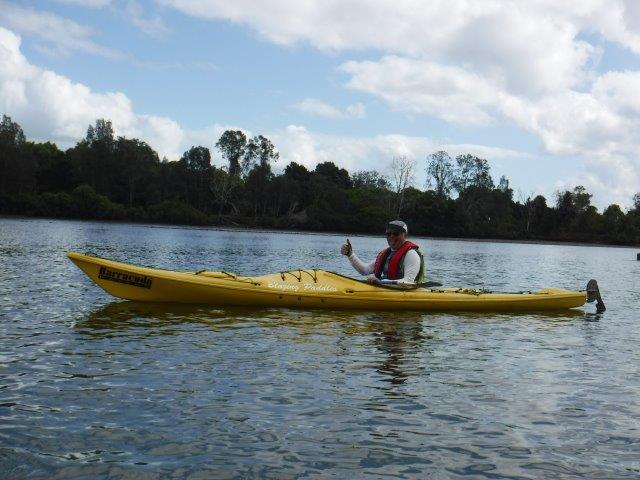
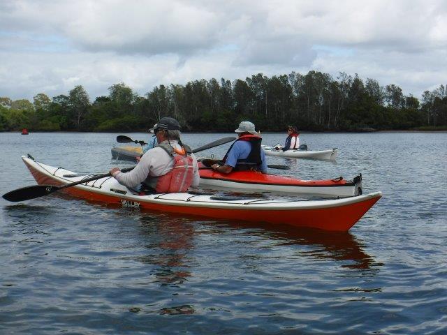
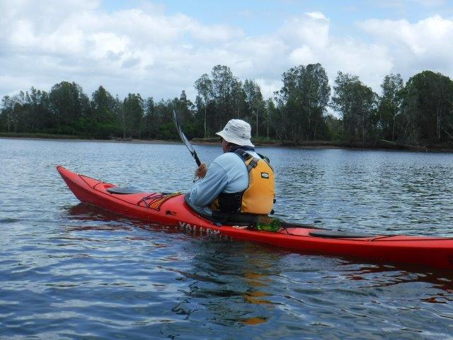
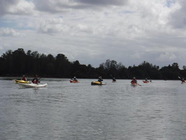
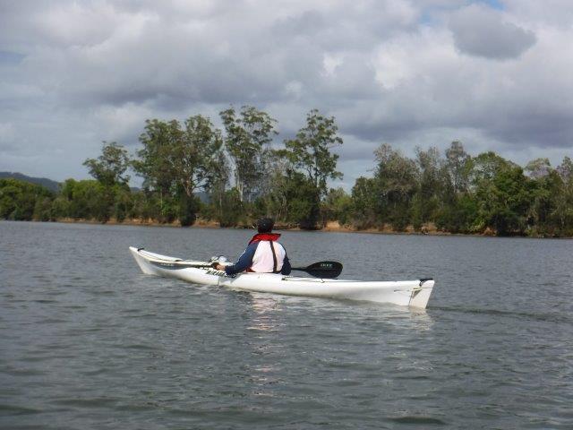
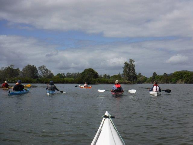
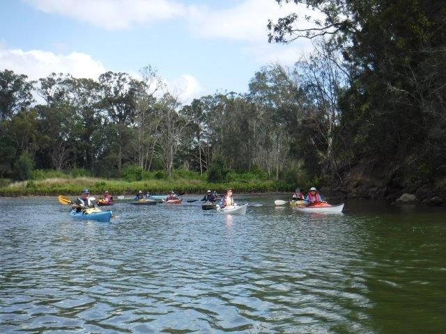
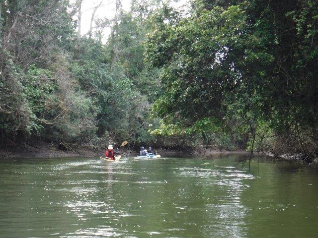
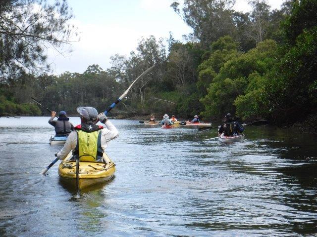
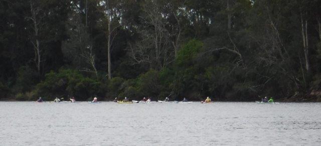
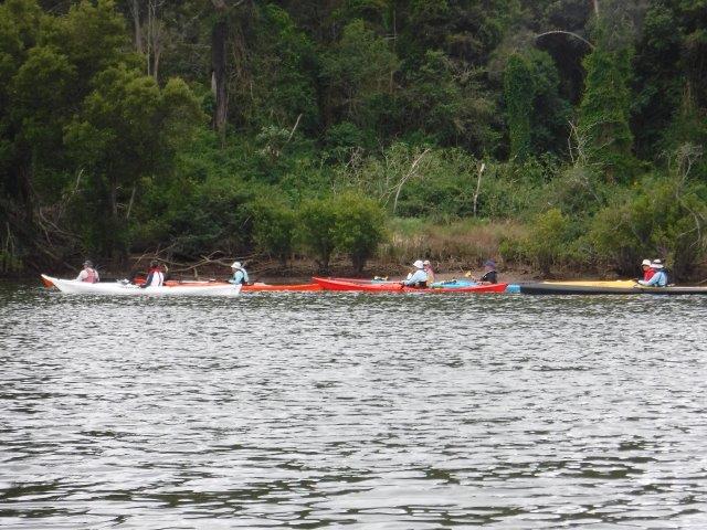
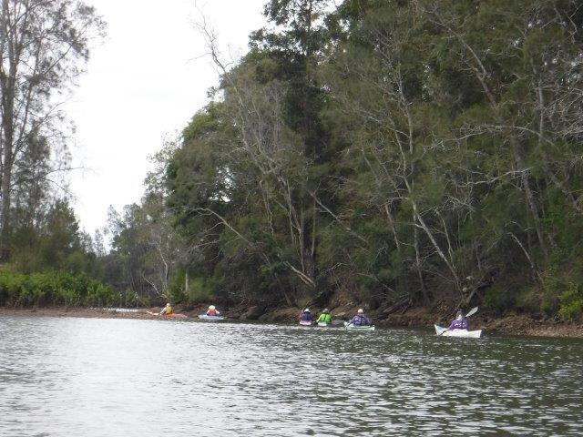
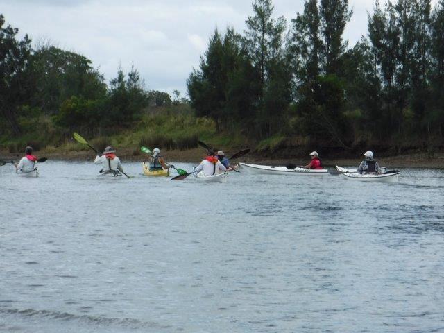
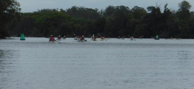
After the morning fog lifted (I was on the highway at Cooperabung before the sun broke through!), ten of us got to enjoy a gorgeous paddle on a picture perfect Killick Creek (estuary) at Crescent Head.


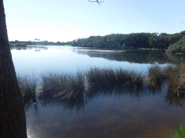
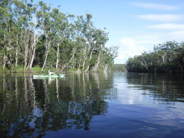
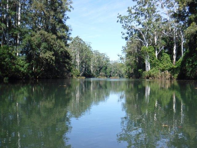
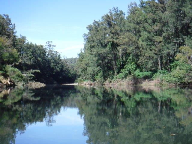
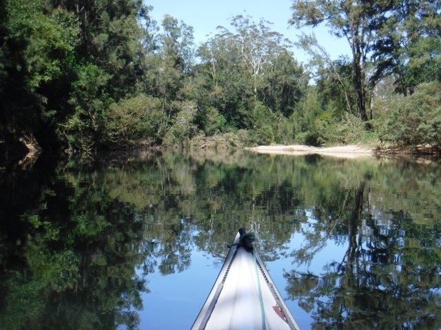
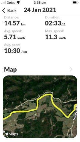
After being indoors so often due to rain ( which is falling again as I write)it was great to get outdoors. We had a good high tide, which is essential on this paddle, and had no problems ( or portages) at the usual shallow areas. This is such a beautiful little (approx.. 9 kms) paddle, right behind the sand dunes of Crescent Head beach in traditional Dunghutti country.


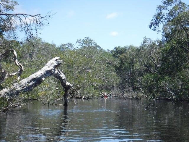
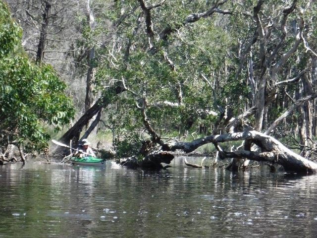
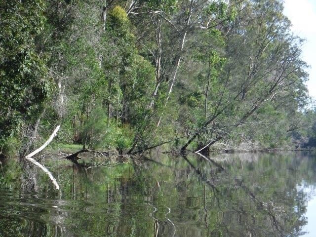
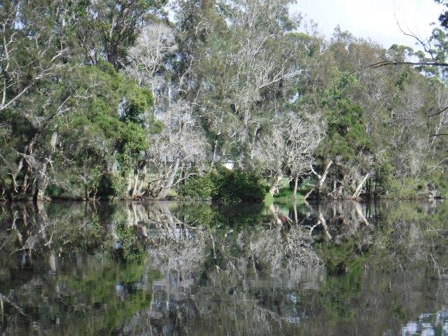
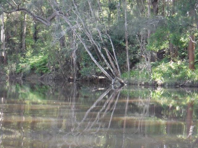
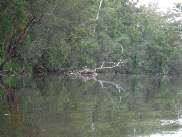
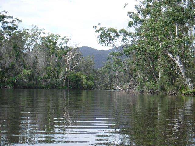
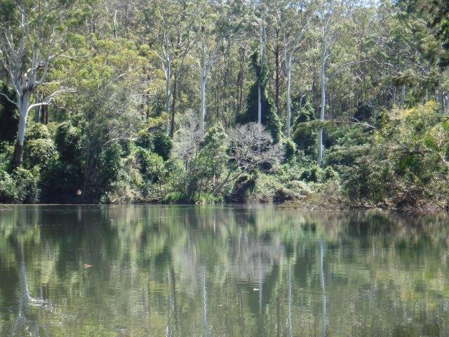
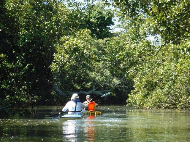
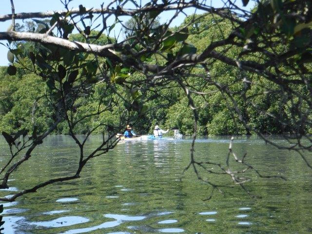
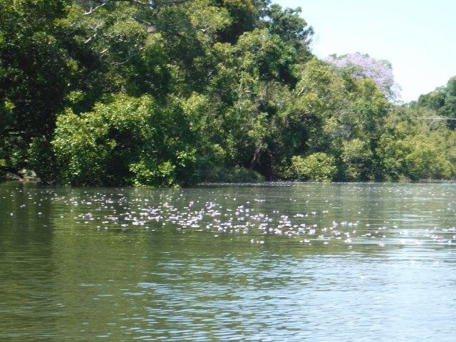
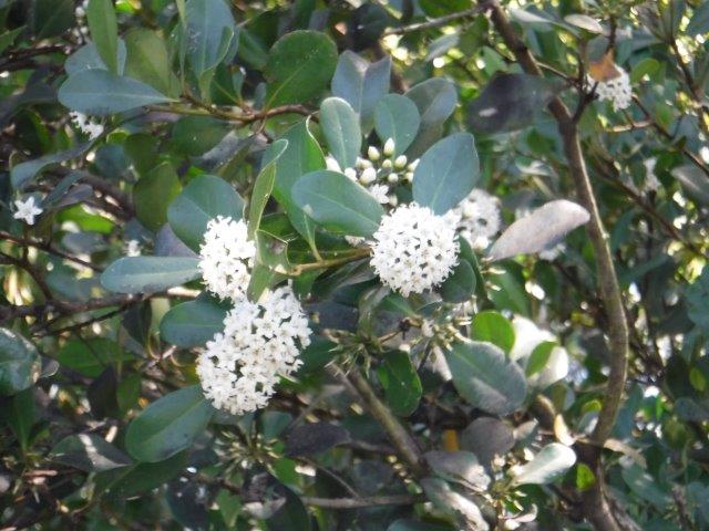
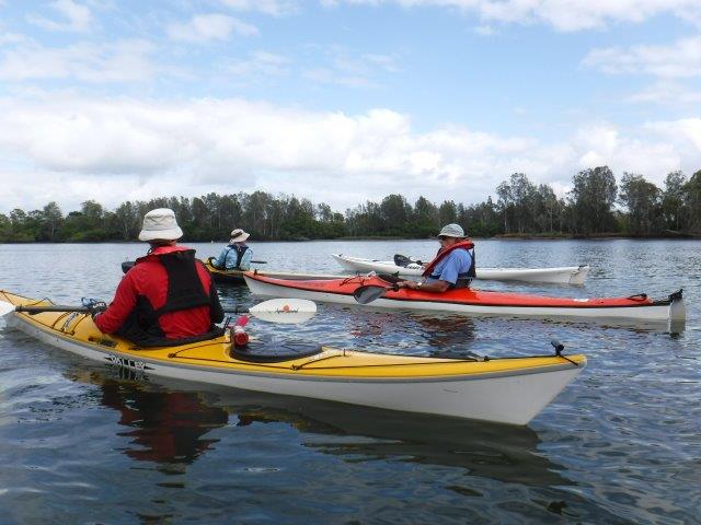
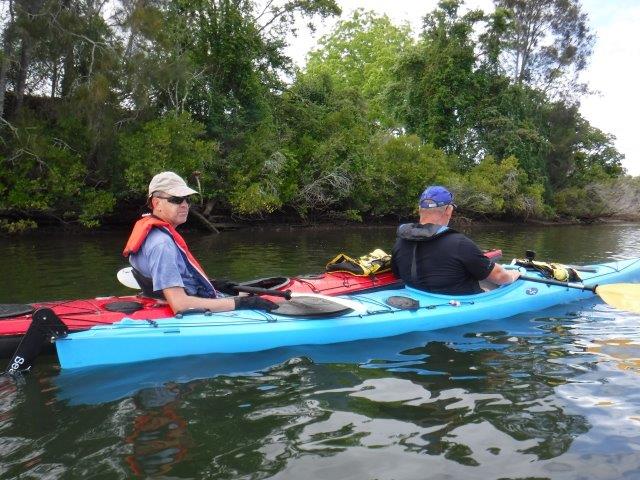
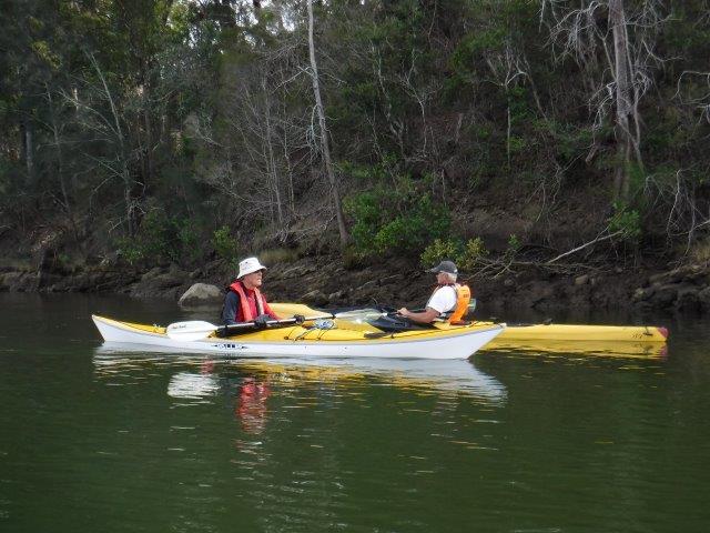
The often eye catching trees and other vegetation muffle the sound of the nearby surf and the occasional osprey and white bellied sea eagle glide across the creek hunting for prey.


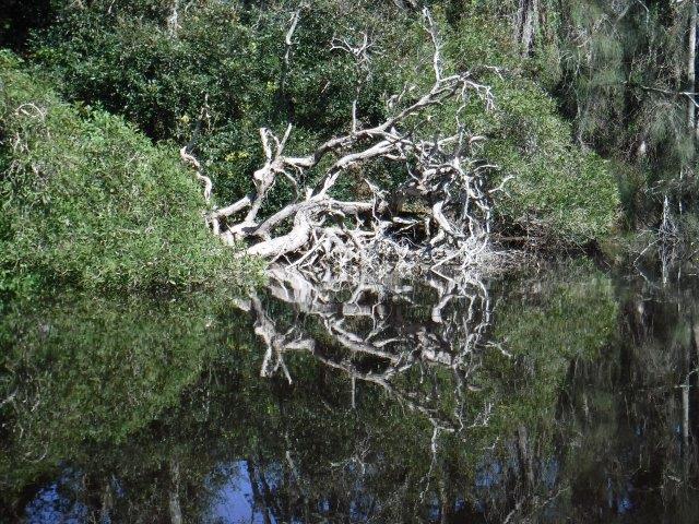
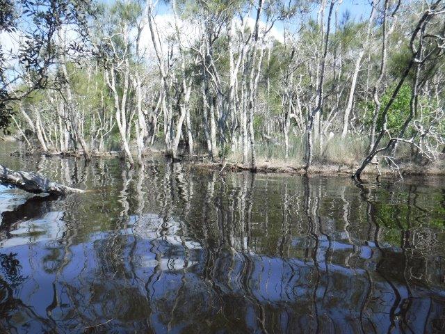
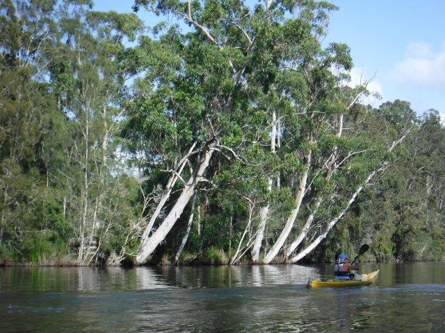
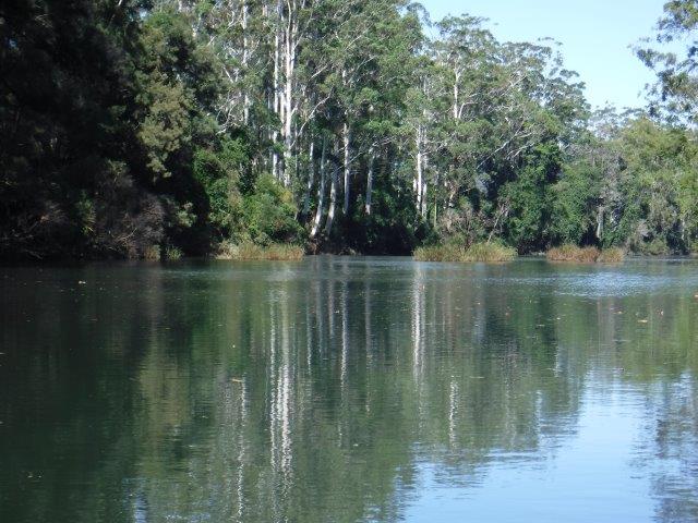
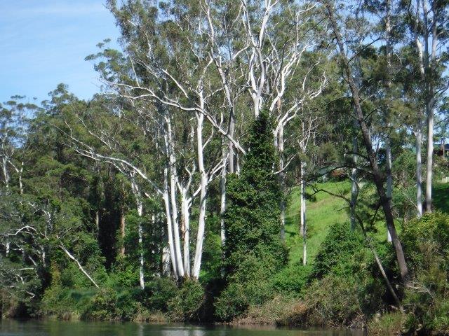
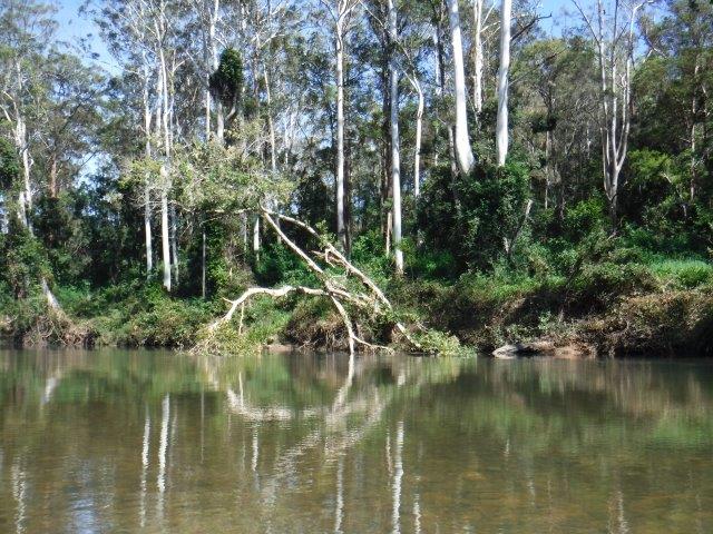
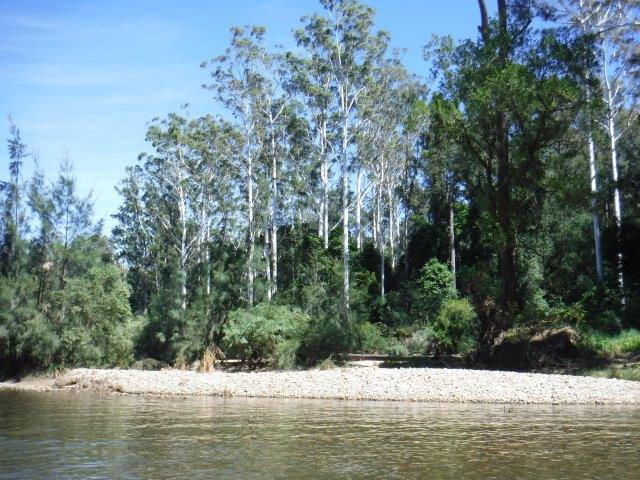
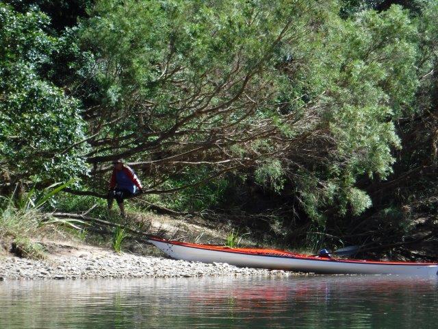
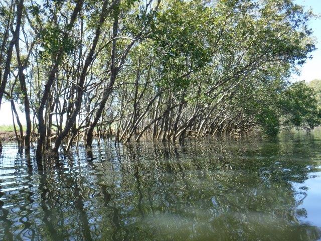
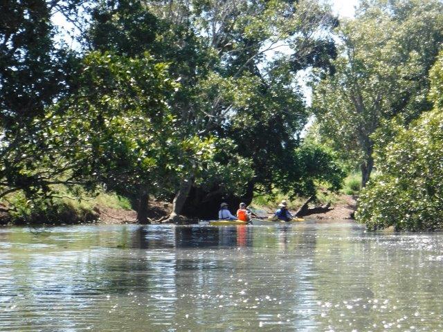
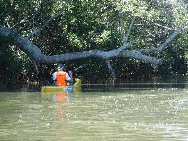
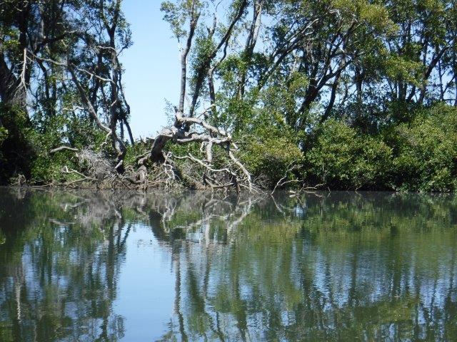
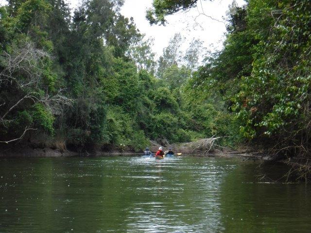
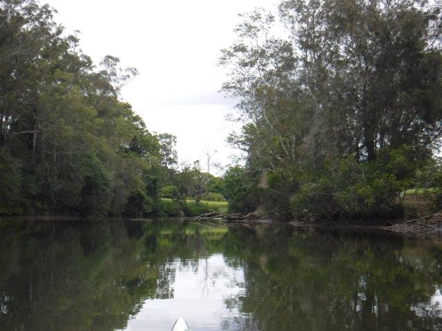
The main feature of the creek to my mind are the fantastic old melaleuca (paperbark) trees. As well as younger trees in their prime, there are some magnificent old trunks, gnarled and twisted with age and exposure to the elements that just ooze character. With their stark white trunks contrasted against the tannin coloured water, even dead trees retain a poignant beauty in death and become features within the landscape of the creek. There are a few that I look for every time we do this paddle and always photograph.


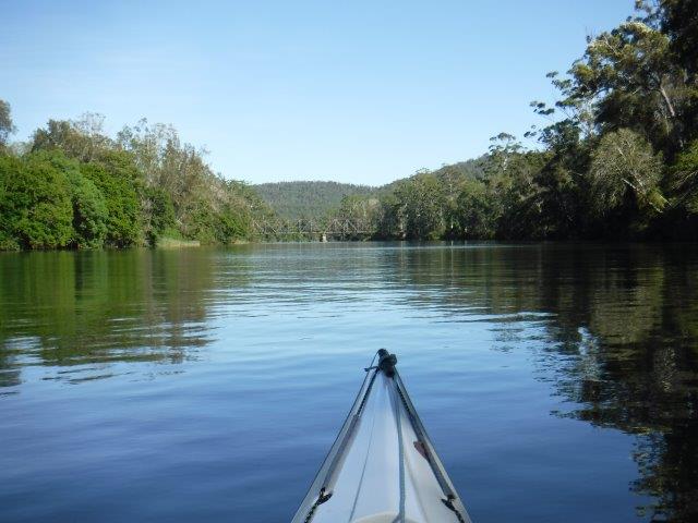
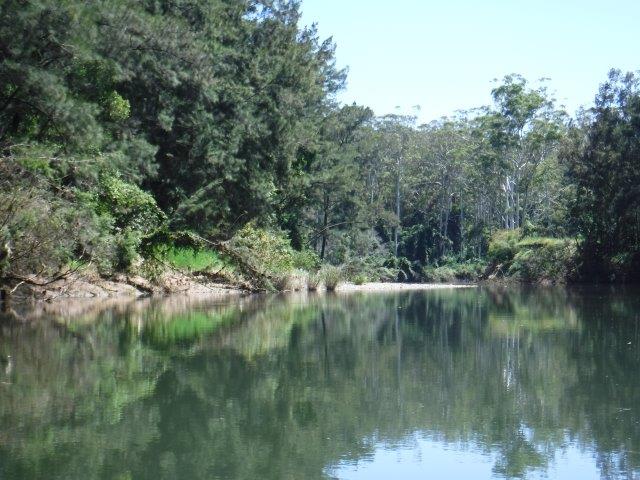
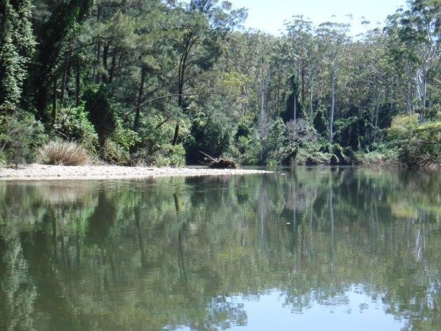
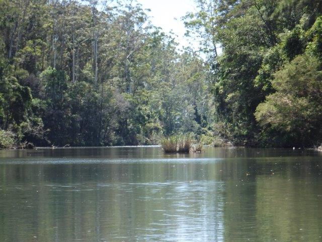
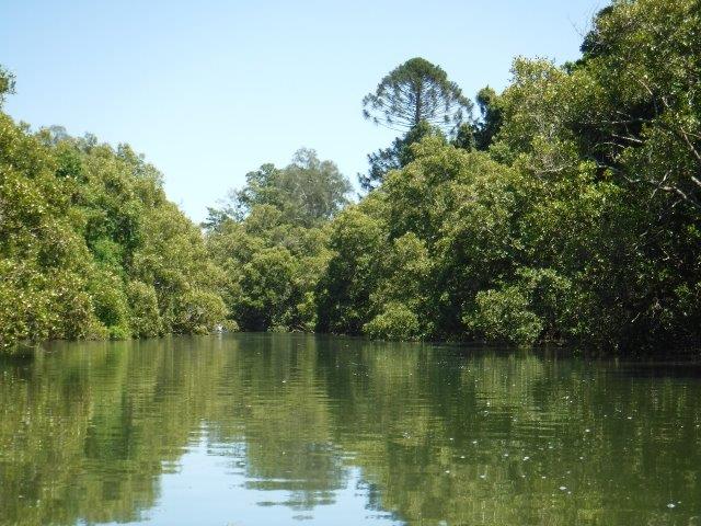
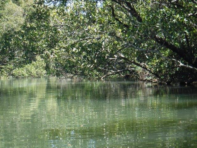
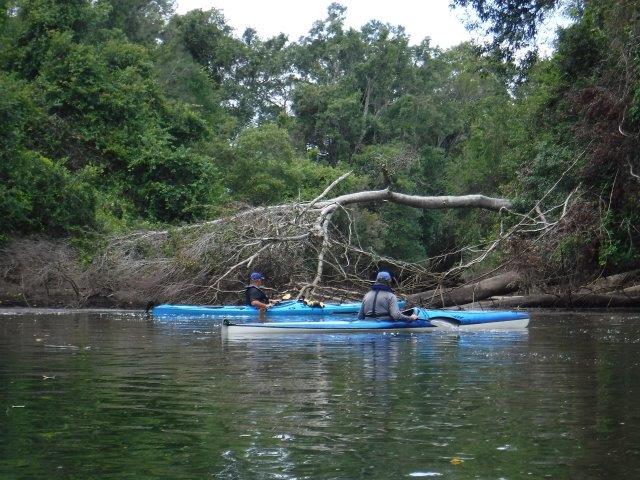
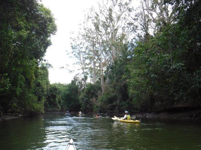
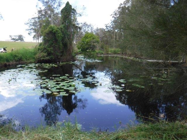
The creek starts off at a bit of a small lagoon with a pretty side creek just to the left full of Mother Nature’s landscaping features. Although it is only short, it is rewarding. The main part of the creek is quite wide and the banks on either side are lined with banksias, casuarinas, melaleucas and assorted smaller trees and shrubs in the understory. As the water was high we explored all the little side inlets which, although choked with fallen tree limbs and branches, are interesting and visually amazing. The last deviation was down the main arm of the creek which goes under the Loftus Rd bridge and ends at a flood/drainage control barrier. 


Killick Creek is described as a small estuary connected to the ocean adjacent to Crescent Head. It is the principal natural waterway through the town. NSW has over 130 estuaries. Collectively they are very important from an ecological, social and economic perspective. They contain diverse ecosystems that form the foundation of the coastal food chain. They are important habitats for marine and land plants and animals.


The way Killick Creek functions is primarily as a result of wave energy. It is classed as a strand plain. This means the estuary would have low sediment trapping efficiency, naturally low turbidity and low risk of habitat loss due to sedimentation (Info from Assessment Framework for Non-Pristine Estuaries – estuary 81 Killick Creek).


Killick Creek serves a major role in the Macleay River Flood Mitigation Scheme. When the floodplains of the Upper Belmore River are inundated, floodwaters discharge into Killick Creek in order to mitigate flood risks and minimize inundation of pasture lands. Flood mitigation works in the 1950’s resulted in the Killick Drain Cutting ( connecting the Upper Belmore and Upper Maria Rivers), a rock training works at the entrance to the estuary along with general widening and deepening of the estuary in some of its upper reaches.


Crescent Head became a favoured surfing spot from the early 1960’s. It became the first stop for surfers travelling along the NSW north coast on their journey north in search of the perfect wave. In June 2008 Crescent Head was declared a National Surfing Reserve, the fourth site in Australia to be thus recognised for its special significance to surfing.


Thanks to those who came along to enjoy this lovely paddle. If you missed it this time, try to pencil it in to your ‘to do/paddle’ list next time it is scheduled.


Cheers
Caroline    

Blog

Herons Creek off Queens Lake


No Comments

Hi everyone,


Well my computer is back on deck after some ‘long service leave’, but has handed in its notice re imminent retirement!!


I am running behind with trip results, but will catch up asap.


We had another lovely paddle on Sunday March 7 on Herons Creek, off Queens Lake. We changed the scheduled paddle from Limeburners & Bobs Creeks due to the poor condition of the road into the Queens Lake Nature Reserve. Herons Creek never disappoints & this day was no exception. With 18 of us, we split into two groups. The first group, led by Bill W included Queensland travellers/visitors Mike, Christine & their paddling pooch Laddie, who hunkered down in the rear hatch of their double. This group paddled to the end of the creek –  16 kms return. The second group, led by Leon, paddled for about an hour or so across the lake and into Herons Creek before retracing their journey to the sailing club & adjourning to North Haven for lunch.


Queens Lake was calm for both crossings and Herons Creek was quiet & picturesque with that lovely sense of remoteness. Flanked on either side by towering trees, we caught glimpses of farms and houses, the vineyard and a few cleared stopping spots that looked fairly recent. It is a relaxing paddle with varied vegetation, rocky outcrops, vines, ferns, eye catching white tree trunks, reflections and vistas.


This area is the traditional land of the Birpai people. By 1822 the first Europeans in the Camden Haven area were soldiers guarding the southern entrance to Port Macquarie. By 1827 the area had been surveyed as part of a grant to the Australian Agricultural Company and by 1856 cedar was being exported through Camden Haven. Laurieton was originally known as the Village of Camden Haven. In 1872 Joseph Laurie and his two brothers moved to the area from Taree. He owned the rights to timber in the area and a timber mill ( near where the Fish Co-Op stands today ). In 1875 he became the first post master. By 1914 a new post office was built in Laurie Street and was called Laurieton by the Post Master General. In 1946 the official name change from the Village of Camden Haven to Laurieton was formalized. 


Other points of interest include  film producer Baz Luhrmann who was raised in Herons Creek township and attended school in Port Macquarie. In 1944 American entertainer Bob Hope was forced to land in the Camden Haven Inlet when his seaplane ( a Catalina Flying Boat ) experienced difficulties when returning from Guam. He and other entertainers had been touring the Pacific entertaining US troops serving in WW2. Hope and members of the group put on a show for the locals who had helped to dig the plane out of the sand spit The area is presided over by beautiful DOORAGAN (North Brother Mountain) and on a clear day the view over the Camden Haven district and its waterways is spectacular.


Thanks Leon and Bill for leading.


Cheers
Caroline         


Blog

Blackmans Point


No Comments

Hi everyone,


Sorry this trip report from two weeks ago is running late, but my computer is having issues with sending multiple photos at present ( or as David Walliams from “Little Britain” put so succinctly…”computer says no” ).
Always a popular paddle, we had a roll up of 21 with 19 doing the main paddle & Bill & Colin paddling up from Blackmans Point, a distance of 22kms.


Given the later start & the pending heat, we split into two groups; one paddled all the way up to the little races & the second paddled for one hour before turning around. Thanks Leon for assisting with this arrangement.
The Wilson is a perennial river of the Hastings River catchment. It is 69 kms long, rising at Mt. Banda Banda in the Willi Willi National Park. Its mouth is at the Maria River, downstream from Telegraph Point. It descends 559m over its course.


The traditional custodians of the country throughout the Telegraph Point & Rollands Plains region are the Ngaku people ( from the coast north of the Wilson & inland to Kemps Pinnacle in the Willi Willi NP); the Ngambaa peoples ( south of the Upper Wilson through Bril Bril towards the Manning) along with the Dunghutti & Birpai peoples.
The Wilson River was named after Lieutenant W.E.B Wilson, an engineer & later Superintendent of Settlement. Governor Macquarie appointed Wilson in 1821 as Engineer & Inspector of Works of the new colony of Port Macquarie. His duties also included exploring & surveying. I cannot locate an Aboriginal name for this river.
The earliest farms along the Wilson were located at Prospect ( near the present site of Telegraph Point) & at Ballengarra. All the Government farms, with the exception of Settlement Farm, were located on the Wilson River. Between 1824 – 32 there were several failed agricultural establishments at Prospect & Rollands Plains where convict workers attempted to grow tobacco, sugar cane, wheat, corn , the goal being to grow as many vegetables as possible to eliminate scurvey from Port Macquarie & its outstations. These farms were overseen by army officers who established penal stations along the river. A telegraph line between Armidale & Port Macquarie was constructed in 1869. In 1876 a new Parish road was built & Rowsell’s private river punt changed to a public ferry with fixed tolls for passengers & livestock. Foot passengers were 2d, each horse or mule was 6d, each sheep was a halfpence & a cart with two wheels was one shilling while a dray with four wheels cost one shilling & 6d ( if only this was still the case!!) A bridge over the Wilson was opened in 1902. It included a lifting span to allow vessels to pass along the river. Dairying became important & a butter factory was opened in 1934 with butter being transported down the Wilson to Port Macquarie. (I have included a few old photos). Many residents relied on the timber industry & droghers ( freight barges) plied the river picking up timber from upstream wharves including Ballengarra. Log Wharf ( in the Reserve where we launch) is the best preserved of these old wharves.


We enjoyed our paddle up the Wilson, particularly the upper reaches above the little grass islands where the river become shallow in places with  smooth river rocks close enough to touch as you glide over them. The banks rise up steeply on the right hand side with glorious straight, white trunked gums soaring up above. It is incredibly picturesque along this stretch & this season the bloodwood trees are flowering in profusion; you could smell their perfume which was sweet & subtle. There are a few more wash away areas that have appeared up this end & our usual spot is still accessible. We had a break here as debris & a strong current in the little race prevented further paddling. 


Thanks to everyone who joined us & we hope you enjoyed the paddle.
Cheers
Caroline


**Historical information from Wikipedia, A History of Telegraph Point & Telegraph Point & Surrounds compiled by Port Macquarie Hastings Council.      

Blog

Ghinni Ghinni Creek at Coopernook


No Comments

Hi everyone,


Twelve of us undertook the paddle down Ghinni Ghinni Creek at Coopernook on Sunday 15 November. We split into two groups with some of us going right down & exploring  Dickensons Creek which branches off to the right just shy of The Other Side Café. Without the lure of coffee & decadent cakes devoured in the shady garden of the café, this paddle will never be quite the same!! (The café was a victim of the early COVID shut down, the owner electing not to continue the café side of her business, sadly for us & many others ).


We had an enjoyable paddle on this winding creek flanked by farming land on both sides & tiers of river & grey mangroves which were in full flower. A few stunning jacaranda trees towered above the trees, their mauve crowns glorious against the backdrop of blue sky, while their fallen blossoms floated on the water. The white mangrove flowers smell a bit like privet but not as strong, & set off some sneezing amongst those of us prone to allergies!! 
Ghinni Ghinni means ‘mud crab’ & Coopernook means ‘elbow’ in the local Biripi language. The latter refers to a bend on the Lansdowne River that resembles an elbow in shape. Ghinni Ghinni Creek runs between Jones Island & the mainland & is approx.. 9 kms in length. It has entrances into both the Manning & Lansdowne Rivers. In the early 1900’s, droghers came up the creek to collect casks of tallow & bags of bones & hide. The hides were salted & bagged up. ( Droghers are cargo boats; described as blunt ended & flat bottomed river boats with plenty of deck space they were generally of robust construction & shallow draught making them ideal for rivers & creeks carrying all manner of goods & foodstuffs to isolated hinterland communities & returning with raw materials to be sent to the bigger cities via ships ). The droghers had to arrive & depart from the Coopernook end as they could not pass under the Ghinni Ghinni bridge. To turn, they were pooled around. Their cargo was loaded onto north coast boats at either Coopernook or Croki wharf & taken to the Sydney markets. Local identity of the times, author & poet Henry “Hawkeye” Edwards recorded that in the 1880’s sailing boats went up Ghinni Ghinni Creek picking up corn from farms. A big wooden plank would be put out between the boat & the bank in order to load the corn. ( The north bound bridge over the Manning is named after “Hawkeye” ). Helping out with boats on the creek could be dangerous work. On March 10, 1891, Hawkeye was involved in an accident at the Cundletown steamers wharf. While acting in the capacity as an agent for a company, he was assisting the steamer Rosedale to dock at about 11pm at night. While standing on an old stone jetty, lantern in hand & waiting to catch the rope to secure the vessel to the wharf, he slipped & fell on his head & side & was rendered unconscious. Fortunately one Constable Hogan was present & rescued him. 


The baker, butcher & grocer all plied their wares up & down the creek. The grocer, a Mr. C.L Harris had a boat called the MYRA ( see photo ) fitted out with shelves & housewives could get a wide range of goods & trade their eggs for groceries.


Coopernook was originally a small river port & developed as a result of sawmilling & ship building. Its wharf was one of a number of wharves along the Manning & its tributaries. There is now a monument in its place as most of the original wharf lay submerged in the river in a deteriorated state. It was proclaimed a village in 1890. The old pub was built in 1928 & the Bascule Bridge over the Lansdowne River was constructed in 1933. The bridge was removed as a result of the Pacific Highway upgrade but the tower component was installed on the foreshore in front of the pub for its historical significance. ( A Bascule bridge is essentially  a lifting bridge; it is a moveable bridge with a counter weight that continuously balances on a pan or leaf throughout its upward swing to provide clearance for boat traffic. The word ‘bascule’ is from the French & is a term meaning balance scale.


Five of us paddled up Dickensons Creek which was very pleasant. It is more narrow than Ghinni Ghinni & we got as far up as a log stock crossing. As the tide was still running in, we decided to turn around rather than risk getting caught out on the return paddle.


After our paddle, the day was heating up & it was pleasant to have lunch in the shade overlooking the ramp & foreshore.


Thanks Martin for volunteering to lead the shorter paddle .


Cheers
Caroline

Blog

Sancrox to Sarahs & King Creek


No Comments

 Hi everyone,


Well we had a full contingent for last Sunday’s paddle from Sancrox upriver to Sarahs & King Creek. It was a lovely morning weather wise & thanks to Di’s friends Keith & Liz Charles for allowing us to launch from their property. It is a beautiful spot just before the Rawdon Island Bridge ( coming from Port ) which they had kindly slashed for us. We welcomed Bruce & Lynne back to Sunday paddles & new members Grant, Steve & Kevin ( & Kevin’s daughter Natasha who was visiting).


Due to the numbers, we split into two groups with Stephen & Greg as leaders. At various times when I was taking pictures along the way, the kayaks looked like an Armada advancing up the river. As the tide was low, we got  excellent close ups of where the treacherous rocks are situated under the bridge & up near Narrow Gut. It was pleasant paddling up around the islands before linking up with the main river again, but we did not get far up Sarahs Creek  due to a fallen tree. A few of us paddled on to King Creek & had better luck but did not paddle all the way up. We crossed paths with the second group on the return trip & all made our way back down to Sancrox. Lunch was back at the launch point overlooking the delightful little ‘Monet’ lilypond.


Sancrox is approximately 12 kms west of Port Macquarie. Records from the Mid North Coast Library revealed that surveys of land around Port started in the 1830’s with a view towards opening up land for free settlers.
The survey here commenced in this area in 1831 & the starting point was the south west corner of the township named Hay ( named after Colonial Under-Secretary Robert William Hay ). It was known as Portion 1. There was a plan for a town but it never eventuated & for generations the area was referred to as Haytown or Haytown Reserve. By the end of the 1800’s there was a timber mill, a wharf & a punt across the river to Rawdon Island. The river at the time was impassable past this point for shipping due to a reef of rocks ( the remnants of which you see at low tide ). The area was, in the beginning, variously called St. Croix, St. Rocks & San Roch ( the latter meaning ‘saint on a sunken rock’) & was the site of a government farm run by a Frenchman. The name Sancrox survived all others, possibly as a misuse of the word San Roch, & was gazetted as such when timber mill workers cottages stood thereabouts. Eventually, the rocks were blasted through, the river dredged & from 1835 onwards ships were able to travel up as far as where Bain Bridge now spans the river.


Sarahs Creek flows from Cowarra Forest & is named after Sarah Allman ( wife of Captain Francis Allman, Commandant & Magistrate of Port Macquarie ) & her first child. Sarahs Creek Bridge was built in 1886 & is purportedly named after one Sarah Suters, wife of local farmer James Suters. 


Thanks to everyone who turned out to support this paddle & to Stephen & Greg for leading.


Hope everyone enjoyed their morning on the water

Cheers Caroline