australia

Blog

Herons Creek off Queens Lake


No Comments

Hi everyone,


Well my computer is back on deck after some ‘long service leave’, but has handed in its notice re imminent retirement!!


I am running behind with trip results, but will catch up asap.


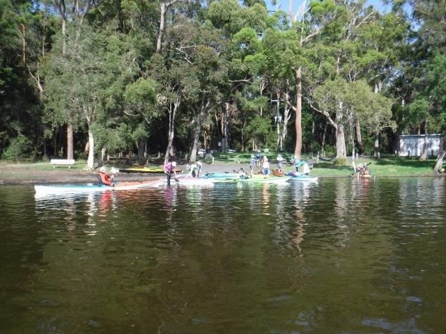
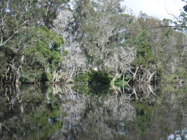
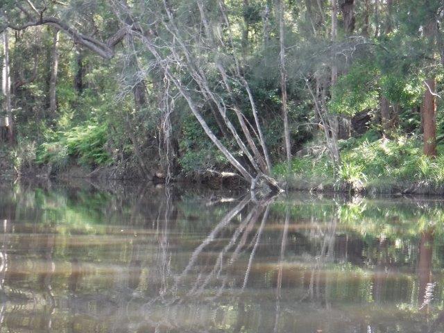
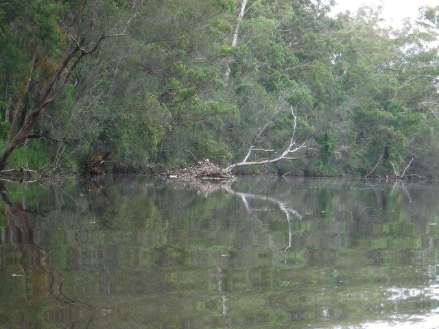
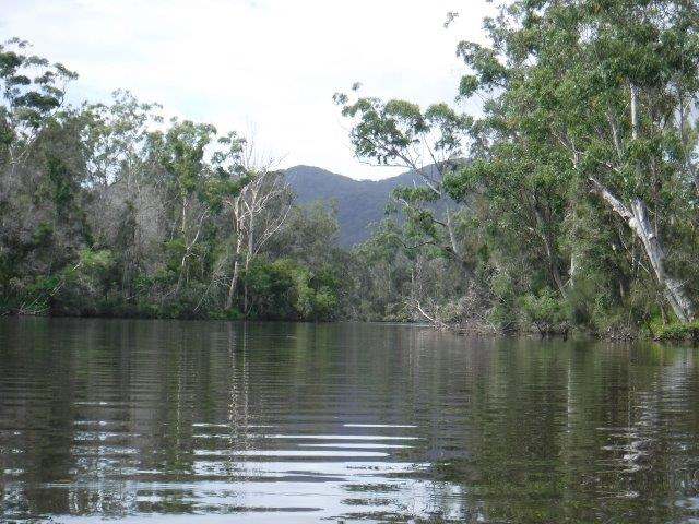
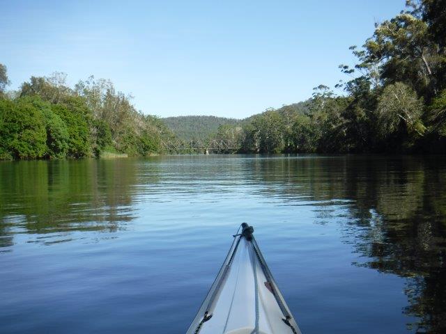
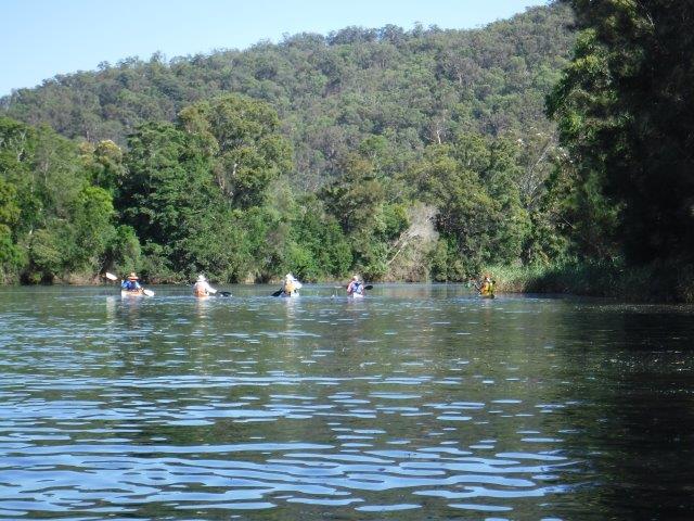
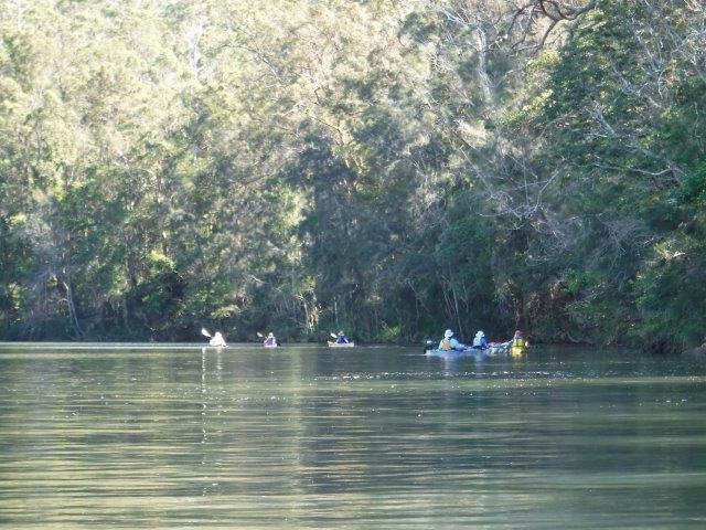
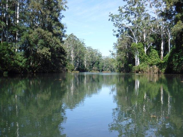
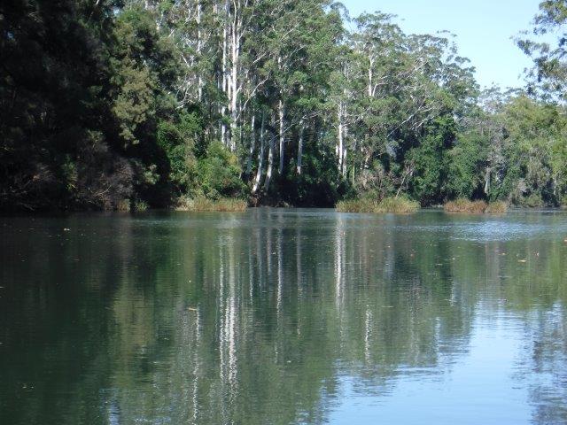
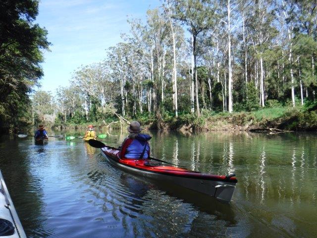
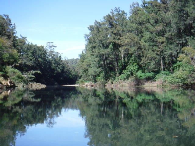
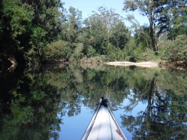
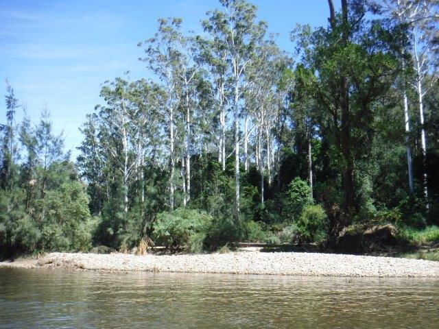
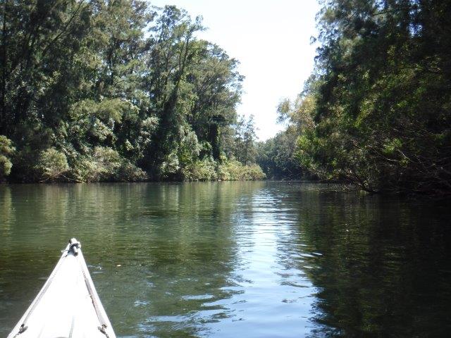
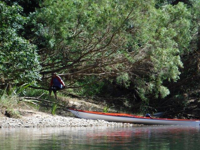
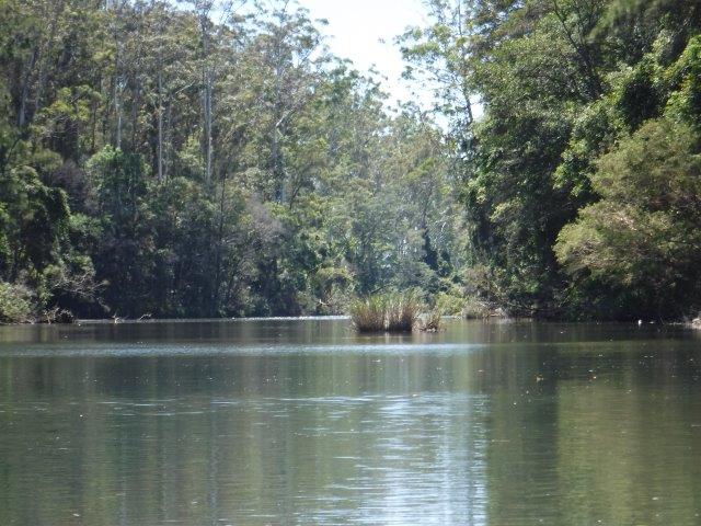
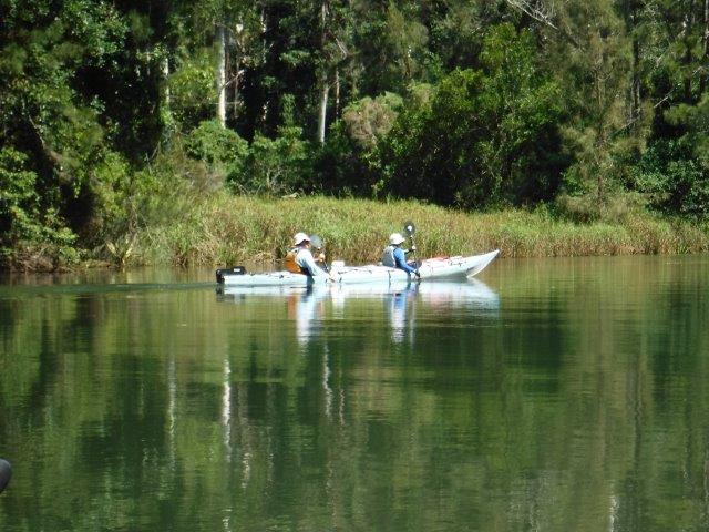
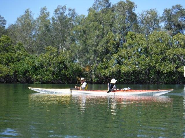
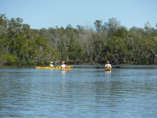
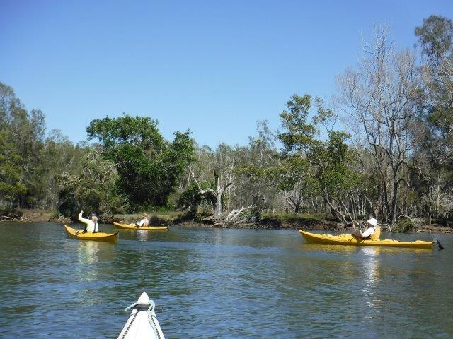
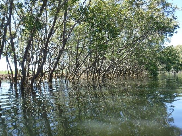
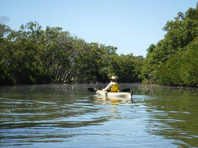
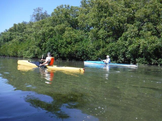
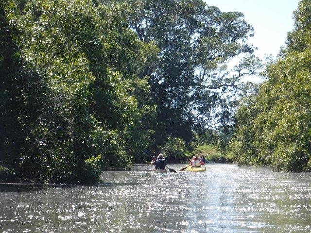
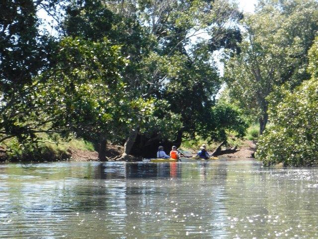
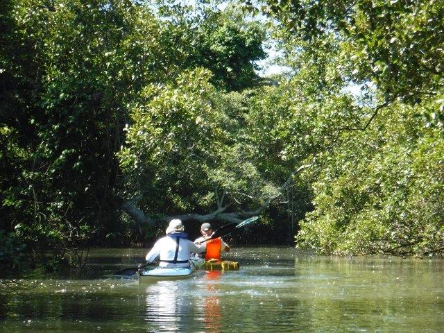
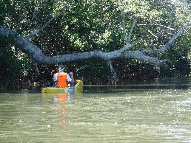
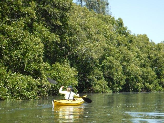
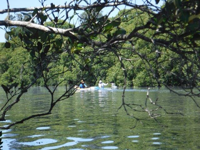
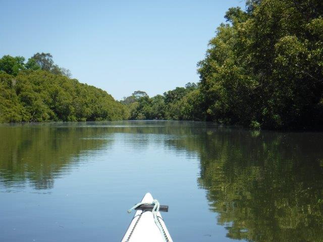
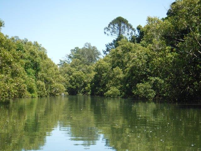
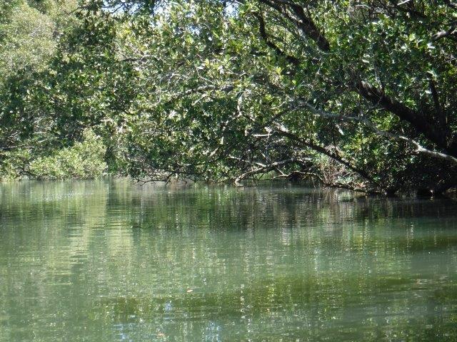
We had another lovely paddle on Sunday March 7 on Herons Creek, off Queens Lake. We changed the scheduled paddle from Limeburners & Bobs Creeks due to the poor condition of the road into the Queens Lake Nature Reserve. Herons Creek never disappoints & this day was no exception. With 18 of us, we split into two groups. The first group, led by Bill W included Queensland travellers/visitors Mike, Christine & their paddling pooch Laddie, who hunkered down in the rear hatch of their double. This group paddled to the end of the creek –  16 kms return. The second group, led by Leon, paddled for about an hour or so across the lake and into Herons Creek before retracing their journey to the sailing club & adjourning to North Haven for lunch.


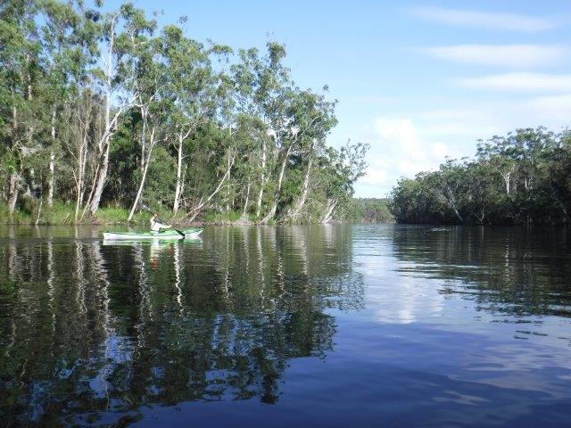
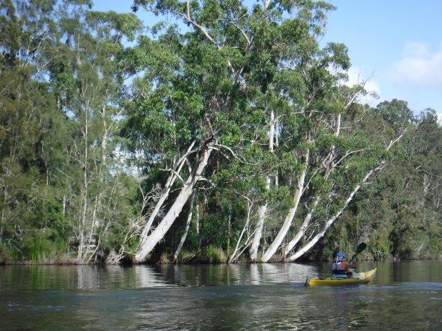
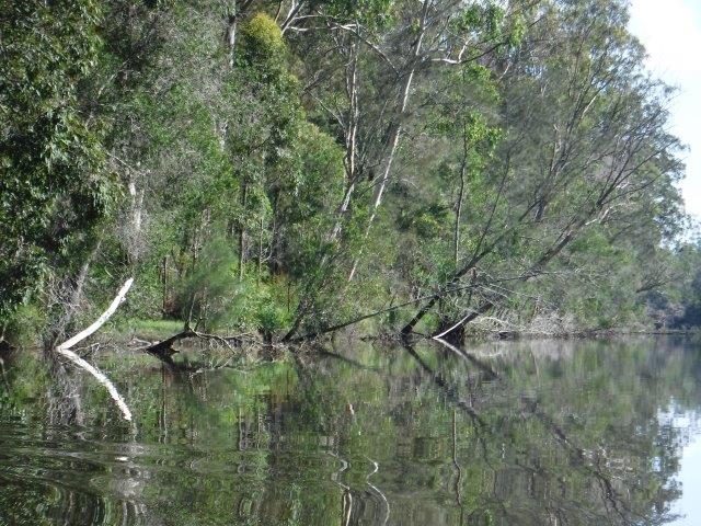
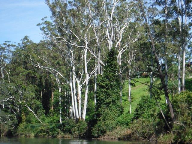
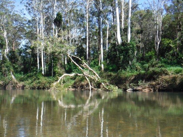
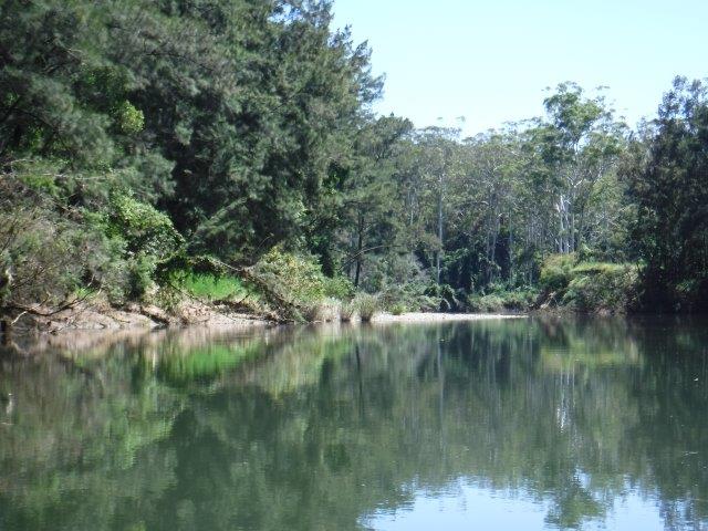
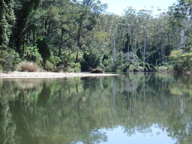
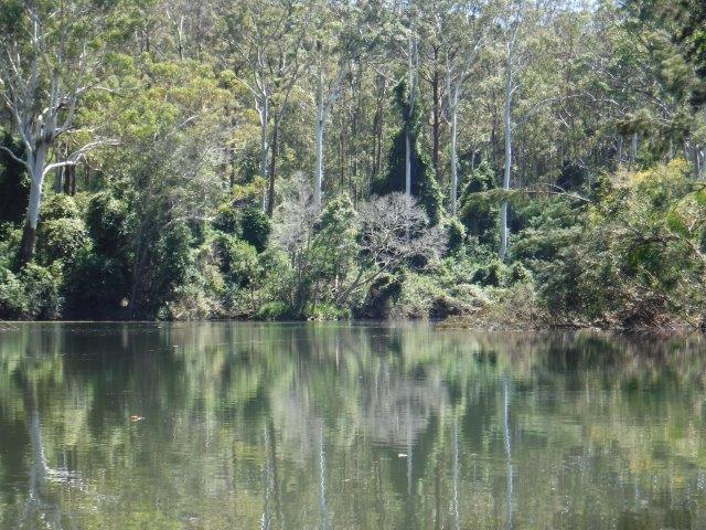
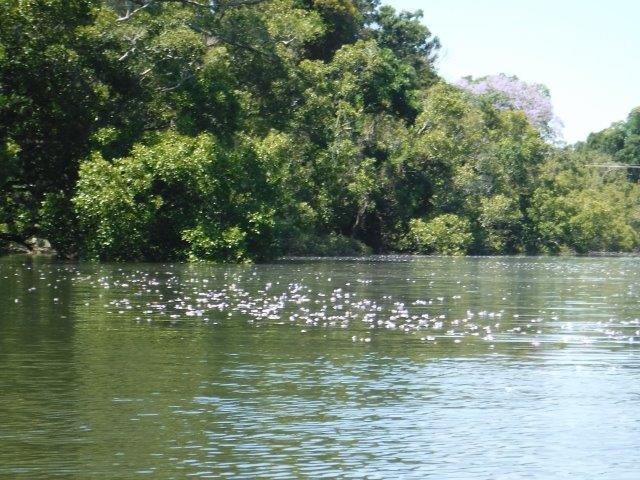
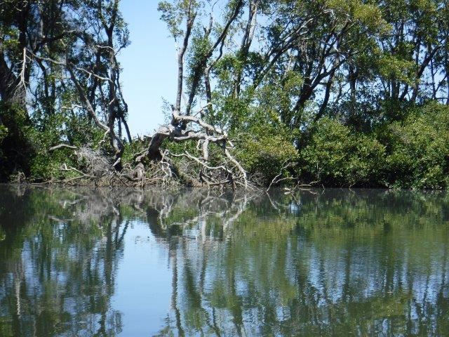
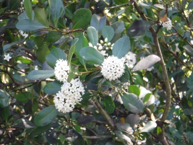
Queens Lake was calm for both crossings and Herons Creek was quiet & picturesque with that lovely sense of remoteness. Flanked on either side by towering trees, we caught glimpses of farms and houses, the vineyard and a few cleared stopping spots that looked fairly recent. It is a relaxing paddle with varied vegetation, rocky outcrops, vines, ferns, eye catching white tree trunks, reflections and vistas.


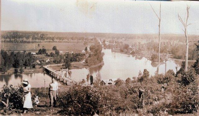
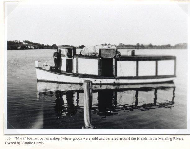
This area is the traditional land of the Birpai people. By 1822 the first Europeans in the Camden Haven area were soldiers guarding the southern entrance to Port Macquarie. By 1827 the area had been surveyed as part of a grant to the Australian Agricultural Company and by 1856 cedar was being exported through Camden Haven. Laurieton was originally known as the Village of Camden Haven. In 1872 Joseph Laurie and his two brothers moved to the area from Taree. He owned the rights to timber in the area and a timber mill ( near where the Fish Co-Op stands today ). In 1875 he became the first post master. By 1914 a new post office was built in Laurie Street and was called Laurieton by the Post Master General. In 1946 the official name change from the Village of Camden Haven to Laurieton was formalized. 


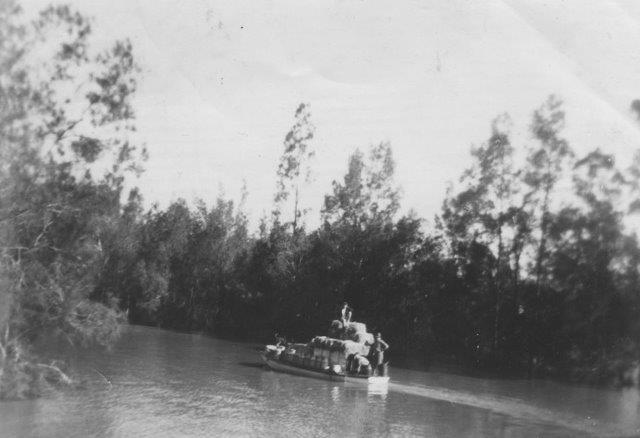
Other points of interest include  film producer Baz Luhrmann who was raised in Herons Creek township and attended school in Port Macquarie. In 1944 American entertainer Bob Hope was forced to land in the Camden Haven Inlet when his seaplane ( a Catalina Flying Boat ) experienced difficulties when returning from Guam. He and other entertainers had been touring the Pacific entertaining US troops serving in WW2. Hope and members of the group put on a show for the locals who had helped to dig the plane out of the sand spit The area is presided over by beautiful DOORAGAN (North Brother Mountain) and on a clear day the view over the Camden Haven district and its waterways is spectacular.


Thanks Leon and Bill for leading.


Cheers
Caroline         


Blog

Blackmans Point


No Comments

Hi everyone,


Sorry this trip report from two weeks ago is running late, but my computer is having issues with sending multiple photos at present ( or as David Walliams from “Little Britain” put so succinctly…”computer says no” ).
Always a popular paddle, we had a roll up of 21 with 19 doing the main paddle & Bill & Colin paddling up from Blackmans Point, a distance of 22kms.


Given the later start & the pending heat, we split into two groups; one paddled all the way up to the little races & the second paddled for one hour before turning around. Thanks Leon for assisting with this arrangement.
The Wilson is a perennial river of the Hastings River catchment. It is 69 kms long, rising at Mt. Banda Banda in the Willi Willi National Park. Its mouth is at the Maria River, downstream from Telegraph Point. It descends 559m over its course.


The traditional custodians of the country throughout the Telegraph Point & Rollands Plains region are the Ngaku people ( from the coast north of the Wilson & inland to Kemps Pinnacle in the Willi Willi NP); the Ngambaa peoples ( south of the Upper Wilson through Bril Bril towards the Manning) along with the Dunghutti & Birpai peoples.
The Wilson River was named after Lieutenant W.E.B Wilson, an engineer & later Superintendent of Settlement. Governor Macquarie appointed Wilson in 1821 as Engineer & Inspector of Works of the new colony of Port Macquarie. His duties also included exploring & surveying. I cannot locate an Aboriginal name for this river.
The earliest farms along the Wilson were located at Prospect ( near the present site of Telegraph Point) & at Ballengarra. All the Government farms, with the exception of Settlement Farm, were located on the Wilson River. Between 1824 – 32 there were several failed agricultural establishments at Prospect & Rollands Plains where convict workers attempted to grow tobacco, sugar cane, wheat, corn , the goal being to grow as many vegetables as possible to eliminate scurvey from Port Macquarie & its outstations. These farms were overseen by army officers who established penal stations along the river. A telegraph line between Armidale & Port Macquarie was constructed in 1869. In 1876 a new Parish road was built & Rowsell’s private river punt changed to a public ferry with fixed tolls for passengers & livestock. Foot passengers were 2d, each horse or mule was 6d, each sheep was a halfpence & a cart with two wheels was one shilling while a dray with four wheels cost one shilling & 6d ( if only this was still the case!!) A bridge over the Wilson was opened in 1902. It included a lifting span to allow vessels to pass along the river. Dairying became important & a butter factory was opened in 1934 with butter being transported down the Wilson to Port Macquarie. (I have included a few old photos). Many residents relied on the timber industry & droghers ( freight barges) plied the river picking up timber from upstream wharves including Ballengarra. Log Wharf ( in the Reserve where we launch) is the best preserved of these old wharves.


We enjoyed our paddle up the Wilson, particularly the upper reaches above the little grass islands where the river become shallow in places with  smooth river rocks close enough to touch as you glide over them. The banks rise up steeply on the right hand side with glorious straight, white trunked gums soaring up above. It is incredibly picturesque along this stretch & this season the bloodwood trees are flowering in profusion; you could smell their perfume which was sweet & subtle. There are a few more wash away areas that have appeared up this end & our usual spot is still accessible. We had a break here as debris & a strong current in the little race prevented further paddling. 


Thanks to everyone who joined us & we hope you enjoyed the paddle.
Cheers
Caroline


**Historical information from Wikipedia, A History of Telegraph Point & Telegraph Point & Surrounds compiled by Port Macquarie Hastings Council.      

Blog

Ghinni Ghinni Creek at Coopernook


No Comments

Hi everyone,


Twelve of us undertook the paddle down Ghinni Ghinni Creek at Coopernook on Sunday 15 November. We split into two groups with some of us going right down & exploring  Dickensons Creek which branches off to the right just shy of The Other Side Café. Without the lure of coffee & decadent cakes devoured in the shady garden of the café, this paddle will never be quite the same!! (The café was a victim of the early COVID shut down, the owner electing not to continue the café side of her business, sadly for us & many others ).


We had an enjoyable paddle on this winding creek flanked by farming land on both sides & tiers of river & grey mangroves which were in full flower. A few stunning jacaranda trees towered above the trees, their mauve crowns glorious against the backdrop of blue sky, while their fallen blossoms floated on the water. The white mangrove flowers smell a bit like privet but not as strong, & set off some sneezing amongst those of us prone to allergies!! 
Ghinni Ghinni means ‘mud crab’ & Coopernook means ‘elbow’ in the local Biripi language. The latter refers to a bend on the Lansdowne River that resembles an elbow in shape. Ghinni Ghinni Creek runs between Jones Island & the mainland & is approx.. 9 kms in length. It has entrances into both the Manning & Lansdowne Rivers. In the early 1900’s, droghers came up the creek to collect casks of tallow & bags of bones & hide. The hides were salted & bagged up. ( Droghers are cargo boats; described as blunt ended & flat bottomed river boats with plenty of deck space they were generally of robust construction & shallow draught making them ideal for rivers & creeks carrying all manner of goods & foodstuffs to isolated hinterland communities & returning with raw materials to be sent to the bigger cities via ships ). The droghers had to arrive & depart from the Coopernook end as they could not pass under the Ghinni Ghinni bridge. To turn, they were pooled around. Their cargo was loaded onto north coast boats at either Coopernook or Croki wharf & taken to the Sydney markets. Local identity of the times, author & poet Henry “Hawkeye” Edwards recorded that in the 1880’s sailing boats went up Ghinni Ghinni Creek picking up corn from farms. A big wooden plank would be put out between the boat & the bank in order to load the corn. ( The north bound bridge over the Manning is named after “Hawkeye” ). Helping out with boats on the creek could be dangerous work. On March 10, 1891, Hawkeye was involved in an accident at the Cundletown steamers wharf. While acting in the capacity as an agent for a company, he was assisting the steamer Rosedale to dock at about 11pm at night. While standing on an old stone jetty, lantern in hand & waiting to catch the rope to secure the vessel to the wharf, he slipped & fell on his head & side & was rendered unconscious. Fortunately one Constable Hogan was present & rescued him. 


The baker, butcher & grocer all plied their wares up & down the creek. The grocer, a Mr. C.L Harris had a boat called the MYRA ( see photo ) fitted out with shelves & housewives could get a wide range of goods & trade their eggs for groceries.


Coopernook was originally a small river port & developed as a result of sawmilling & ship building. Its wharf was one of a number of wharves along the Manning & its tributaries. There is now a monument in its place as most of the original wharf lay submerged in the river in a deteriorated state. It was proclaimed a village in 1890. The old pub was built in 1928 & the Bascule Bridge over the Lansdowne River was constructed in 1933. The bridge was removed as a result of the Pacific Highway upgrade but the tower component was installed on the foreshore in front of the pub for its historical significance. ( A Bascule bridge is essentially  a lifting bridge; it is a moveable bridge with a counter weight that continuously balances on a pan or leaf throughout its upward swing to provide clearance for boat traffic. The word ‘bascule’ is from the French & is a term meaning balance scale.


Five of us paddled up Dickensons Creek which was very pleasant. It is more narrow than Ghinni Ghinni & we got as far up as a log stock crossing. As the tide was still running in, we decided to turn around rather than risk getting caught out on the return paddle.


After our paddle, the day was heating up & it was pleasant to have lunch in the shade overlooking the ramp & foreshore.


Thanks Martin for volunteering to lead the shorter paddle .


Cheers
Caroline

Blog

Kundabung: Pipers Creek


No Comments

Hi everyone,

You can’t help but fall in love ( all over again if you have paddled it before ) with Pipers Creek on a clear, sunny morning.

Nestled down amongst some magnificent trees, this perfect little paddle never disappoints & remains one of my personal favourites.

No matter the conditions, it is always picturesque & atmospheric & there is always a reflection ( or two or three or four ) which takes your breath away.
This gorgeous creek is very secluded & located at the end of a tree lined dirt road in the sleepy hamlet of Kundabung ( which translates to ‘Black Apple Tree’ ).

Unfortunately there were quite a few campers set up there when we arrived…all 23 of us plus kayaks…so it was a not as ‘secluded’ as usual!! However, once out on the water we had the creek all to ourselves.

To comply with social distancing we divided into three groups with one electing to paddle down to the Maria River & the other two paddling up north…the pretty end of this creek.

I could rave on about the beauty of the natural landscape along Pipers Creek, but I will let the photos speak for themselves. Instead, some history as it has a fascinating back story.

Believed to be names after one Captain Piper who was involved in survey work, it was on an exploratory & survey expedition in 1831 that Surveyor Ralfe discovered a stratum of limestone of a very superior quality about six miles from the head of navigation of Pipers Creek. The Police Magistrate at Port Macquarie provided 20 convicts to make a road from the Wilson River to construct a kiln for the burning of limestone. Cells were built for the convicts to sleep in at night. Some kilns still remain ( I have included two photos ). The limestone was burned up on site & conveyed to the loading wharf at Kundabung ( where we launch  ) on low wagons with wooden wheels hauled by a team of convicts. Lime from these kilns was used in the construction of many of the convict-built buildings in Port. Once the lime was loaded onto barges at the wharf, convicts were again used to row those boats all the way down Pipers Creek, into the Maria River, then into the Wilson & finally into the Hastings & into Port Macquarie!!! So if you think you do a few long paddles, spare a thought for these poor convicts!!!
Pipers Creek rises within the Ballengarra State Forest & flows east by south then south before reaching its confluence with the Maria River. It descends 177 m over its 32 km course.

The first European settlers in the Kundabung district were engaged in the timber industry. Logs were brought out of the bush on skids & then hauled by horses to the wharves on either side where Smiths Creek enters Pipers Creek. They were then transported via a log punt to Hibbards Mill in Port Macquarie. The early settlement was referred to as Smiths Creek; the name change came as the settlement got bigger.

After enjoying our paddle, which was cut short by a fallen tree which we could not negotiate as the tide was turning, we headed up to Kundabung where we had our picnic lunch in the grounds near the community hall. Sorry we could not enjoy our usual campfire, but the reserve was too crowded. Hopefully next time, once the ‘tourists’ move on.

Hope everyone enjoyed their paddle. Thanks Barry for organising the paddle.

Cheers
Caroline

This slideshow requires JavaScript.

Blog

Balyngara & Stony Creek


No Comments

Hi everyone,

Further to Leon’s report on the Balyngara & Stony Creek paddle, here are some photos & extra information. Sorry I am running late!!

Twelve of us put in at the old ramp on the private property on Little Rawdon Island. This paddle is like a package deal as it comes with a pleasant Sunday drive through the green farming land of Rawdon Island with its sprawling properties, sleek cattle & peaceful vistas.

Rawdon Island was named after Francis Rawdon Hastings, the 1st Marquis of Hastings. The locale is made up of two islands…Rawdon & Little Rawdon Islands. The communities once boasted 27 dairy farms, two churches, a school, community hall & a footy team! The beautiful buildings of the old school are now a heritage function house. We are always grateful to the Galloways for allowing us to use their property to access the river up here as a starting point for our paddle.

After launching we paddled to the right under Little Rawdon Island bridge which always makes me think of Huckleberry Finn with people sitting fishing, their legs dangling over the edge of this narrow, one way bridge. We then veered right into Munns Channel with Quetta Island on our left. At the end we crossed over the main river & into Balyngara Creek, a wide creek flanked by farming land & lovely trees, before veering left into Stony Creek. It was perfect weather & calm water with nice reflections. We have not done this paddle for quite sometime & it was great to become reacquainted.

When a small group of us got back to the junction with Balyngara, four of us decided to paddle down to the end of this creek exploring. The remainder elected to wait for the others to catch up & then head back, & this is where Leon’s story starts.

We paddled right down Balyngara & into Loggy Creek but were pulled up in our tracks quick smart by a fallen tree. Back on Balyngara we paddled down to the Pembroke Rd. bridge. The spot where we used to have a cuppa now has a ‘pop up’ bush camp ( a bit ‘deliverance’ looking ) which I don’t think is quite legal as this area is Cairncross  State Forest. Our paddle back was uneventful & we enjoyed the peace & quiet & feeling of remoteness in this part of the river.
After making contact with the rest of the group by phone when we got back, we enjoyed a quiet lunch before helping the ‘wanderers’ back up with their kayaks.

Cheers
Caroline

This slideshow requires JavaScript.