Blog

Blog

Blackmans Point


No Comments

Hi everyone,


Sorry this trip report from two weeks ago is running late, but my computer is having issues with sending multiple photos at present ( or as David Walliams from “Little Britain” put so succinctly…”computer says no” ).
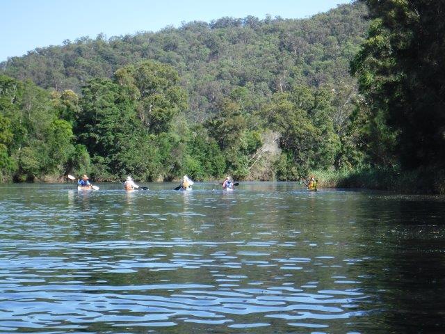
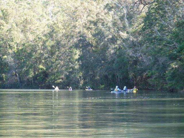
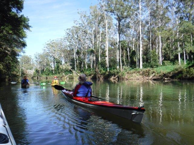
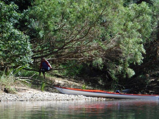
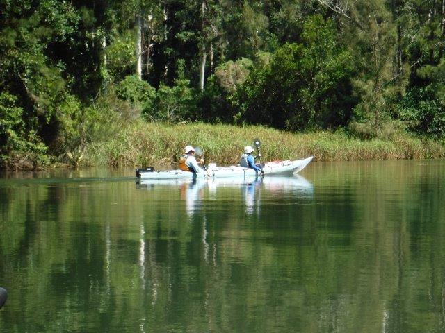
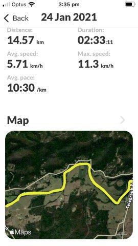
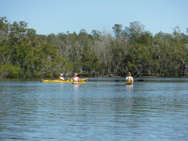
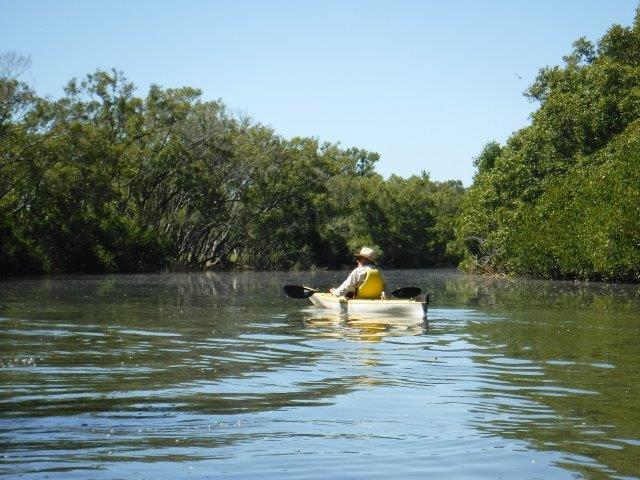
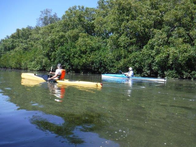
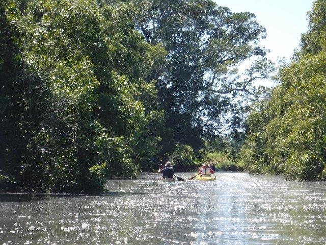
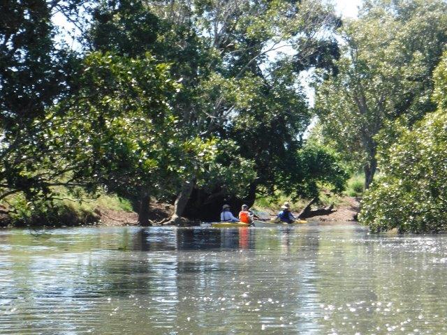
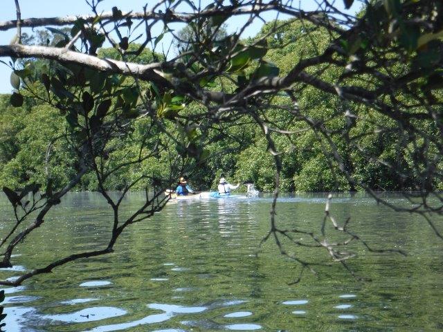
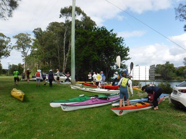
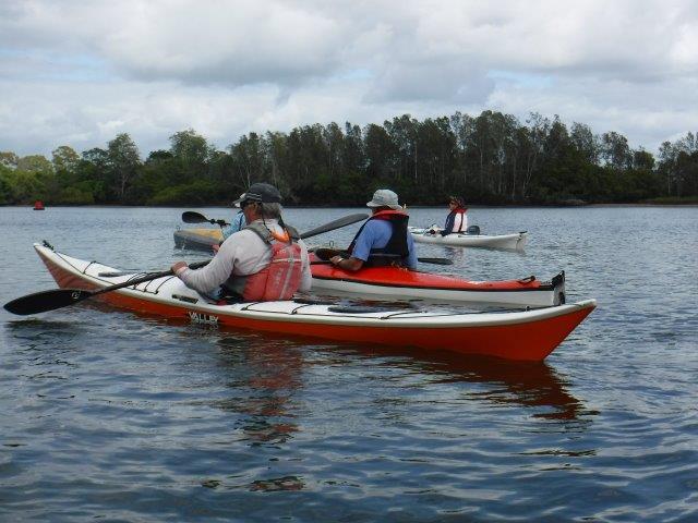
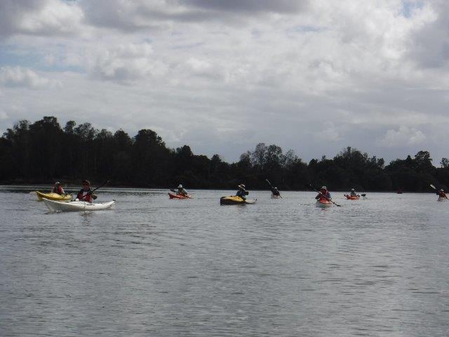
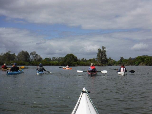
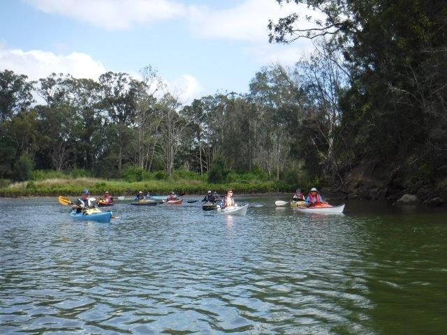
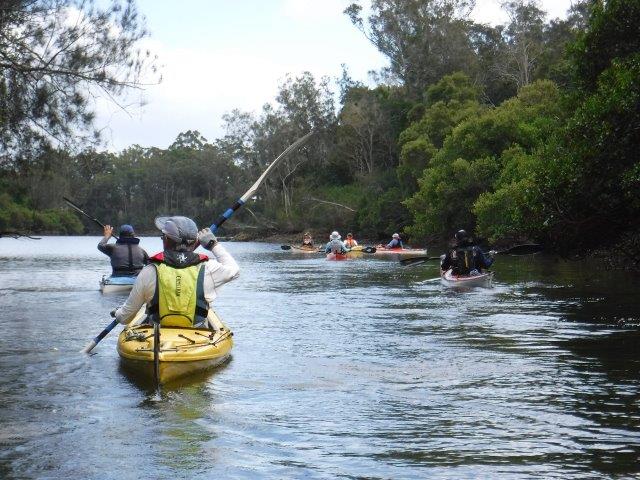
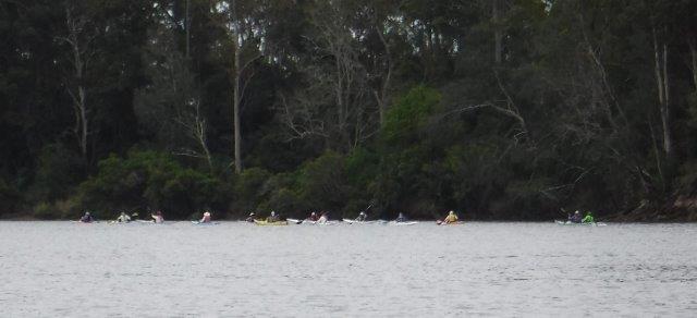
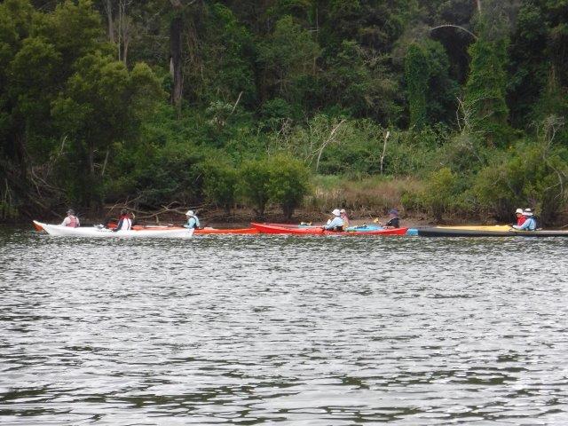
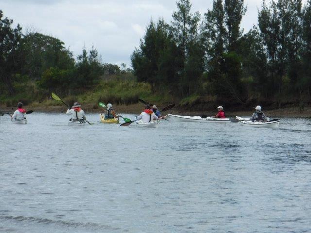
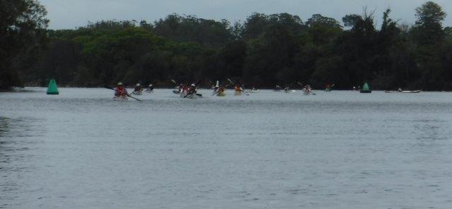
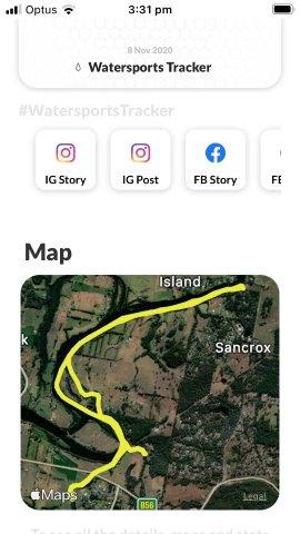
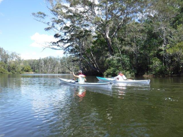
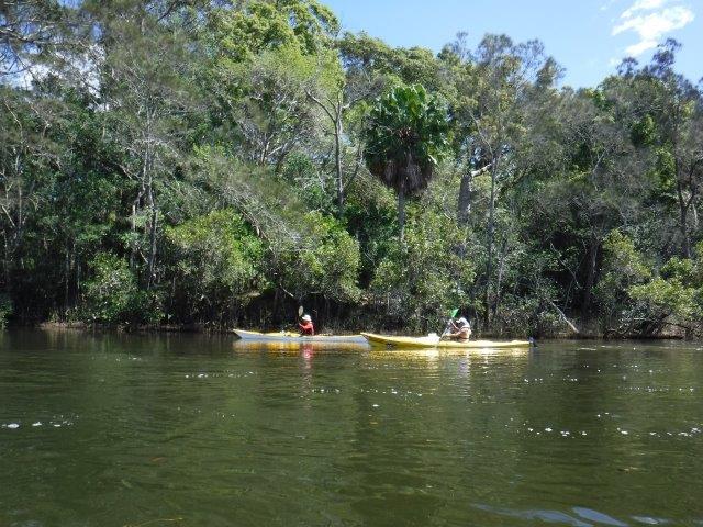
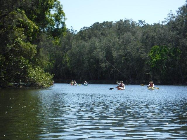
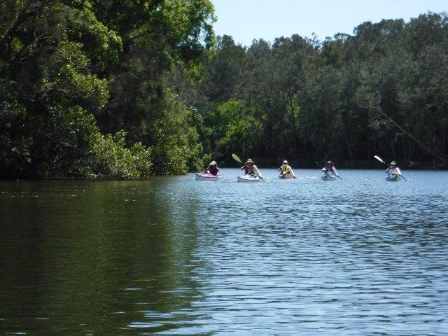
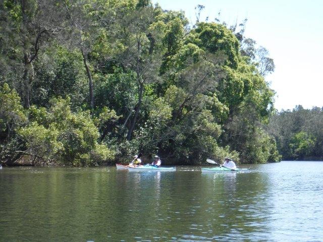
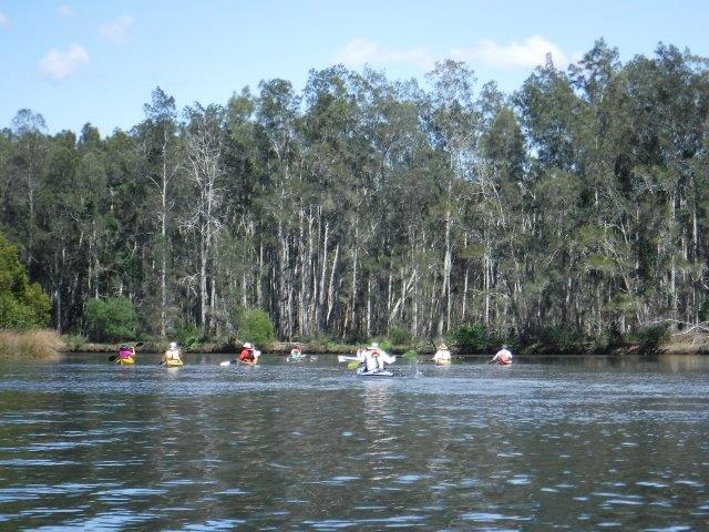
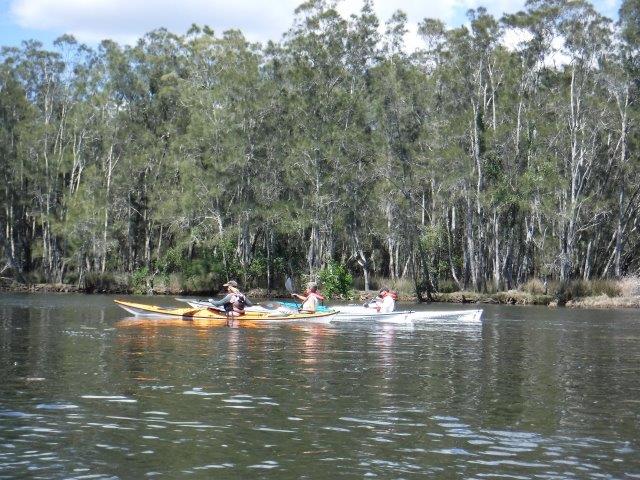
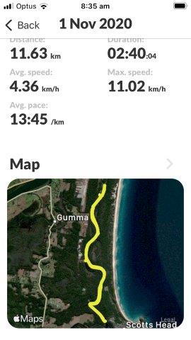
Always a popular paddle, we had a roll up of 21 with 19 doing the main paddle & Bill & Colin paddling up from Blackmans Point, a distance of 22kms.


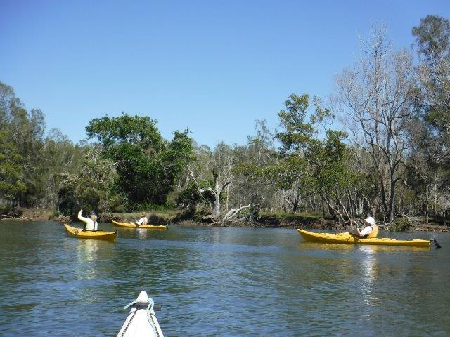
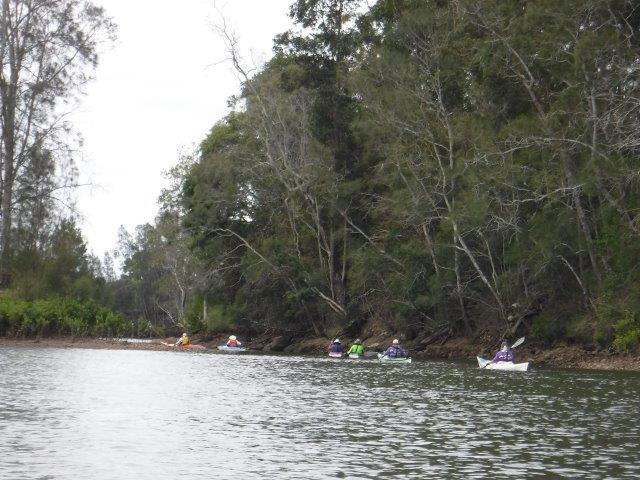
Given the later start & the pending heat, we split into two groups; one paddled all the way up to the little races & the second paddled for one hour before turning around. Thanks Leon for assisting with this arrangement.
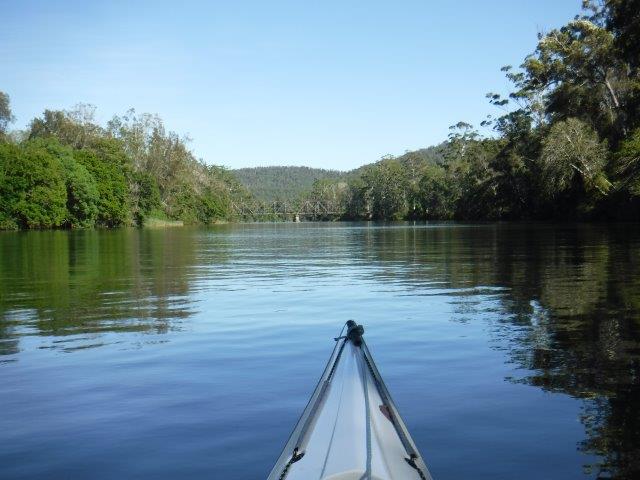
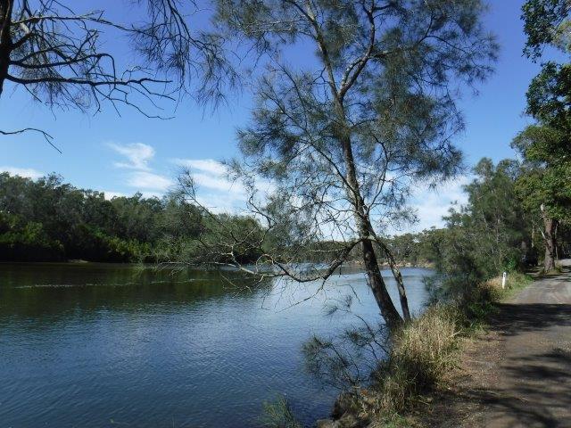
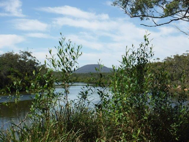
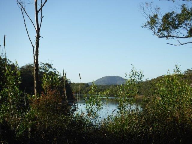
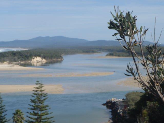
The Wilson is a perennial river of the Hastings River catchment. It is 69 kms long, rising at Mt. Banda Banda in the Willi Willi National Park. Its mouth is at the Maria River, downstream from Telegraph Point. It descends 559m over its course.


The traditional custodians of the country throughout the Telegraph Point & Rollands Plains region are the Ngaku people ( from the coast north of the Wilson & inland to Kemps Pinnacle in the Willi Willi NP); the Ngambaa peoples ( south of the Upper Wilson through Bril Bril towards the Manning) along with the Dunghutti & Birpai peoples.
The Wilson River was named after Lieutenant W.E.B Wilson, an engineer & later Superintendent of Settlement. Governor Macquarie appointed Wilson in 1821 as Engineer & Inspector of Works of the new colony of Port Macquarie. His duties also included exploring & surveying. I cannot locate an Aboriginal name for this river.
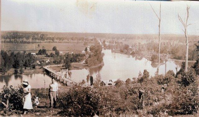
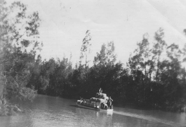
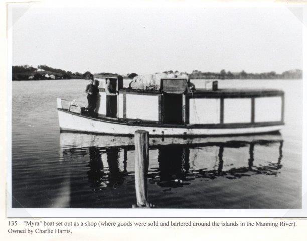
The earliest farms along the Wilson were located at Prospect ( near the present site of Telegraph Point) & at Ballengarra. All the Government farms, with the exception of Settlement Farm, were located on the Wilson River. Between 1824 – 32 there were several failed agricultural establishments at Prospect & Rollands Plains where convict workers attempted to grow tobacco, sugar cane, wheat, corn , the goal being to grow as many vegetables as possible to eliminate scurvey from Port Macquarie & its outstations. These farms were overseen by army officers who established penal stations along the river. A telegraph line between Armidale & Port Macquarie was constructed in 1869. In 1876 a new Parish road was built & Rowsell’s private river punt changed to a public ferry with fixed tolls for passengers & livestock. Foot passengers were 2d, each horse or mule was 6d, each sheep was a halfpence & a cart with two wheels was one shilling while a dray with four wheels cost one shilling & 6d ( if only this was still the case!!) A bridge over the Wilson was opened in 1902. It included a lifting span to allow vessels to pass along the river. Dairying became important & a butter factory was opened in 1934 with butter being transported down the Wilson to Port Macquarie. (I have included a few old photos). Many residents relied on the timber industry & droghers ( freight barges) plied the river picking up timber from upstream wharves including Ballengarra. Log Wharf ( in the Reserve where we launch) is the best preserved of these old wharves.


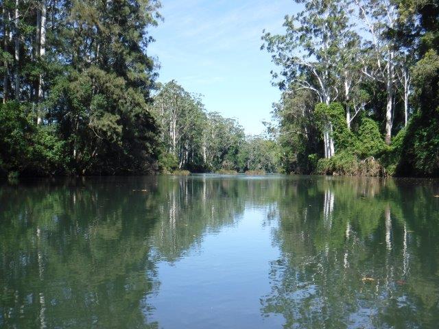
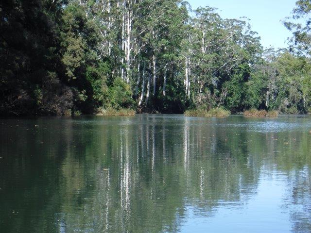
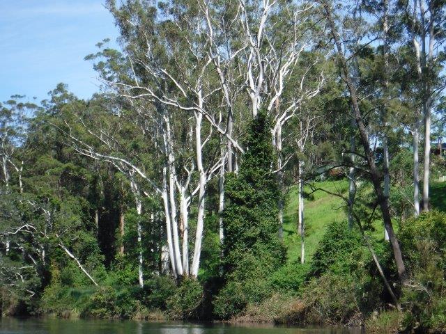
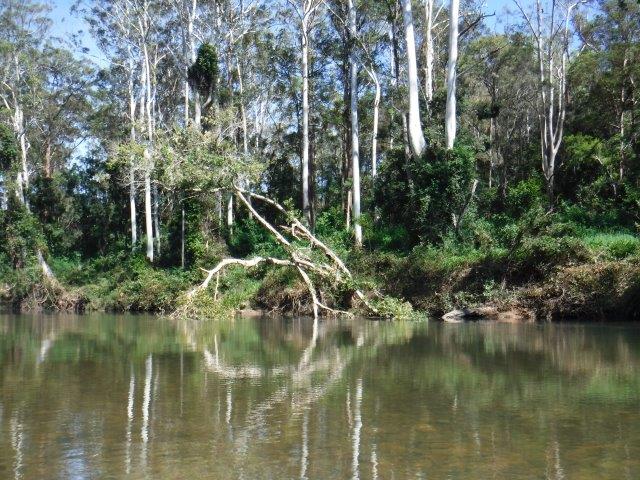
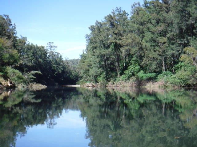
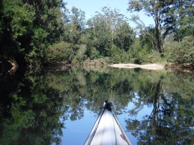
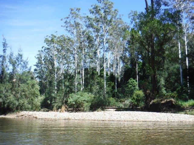
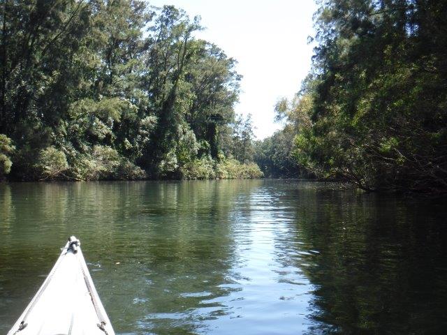
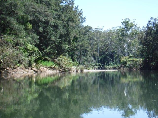
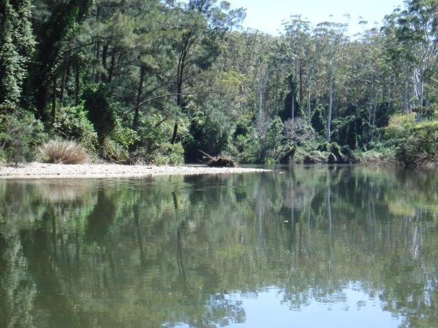
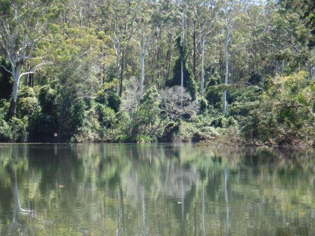
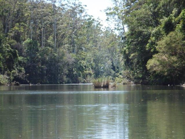
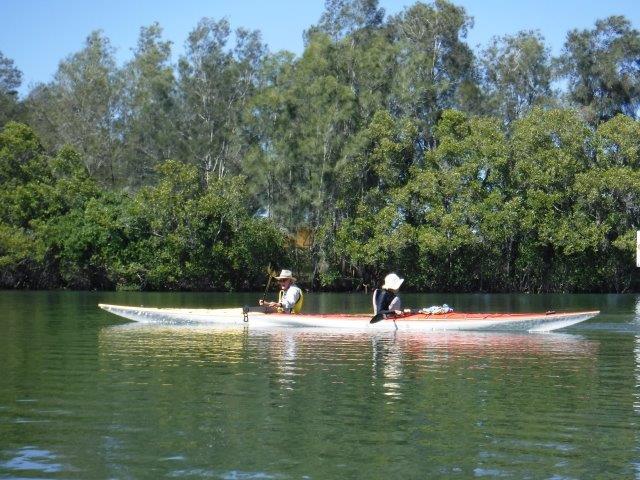
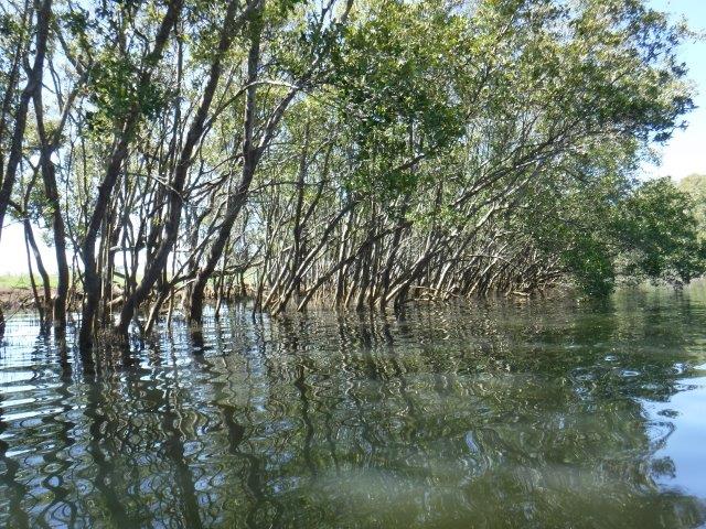
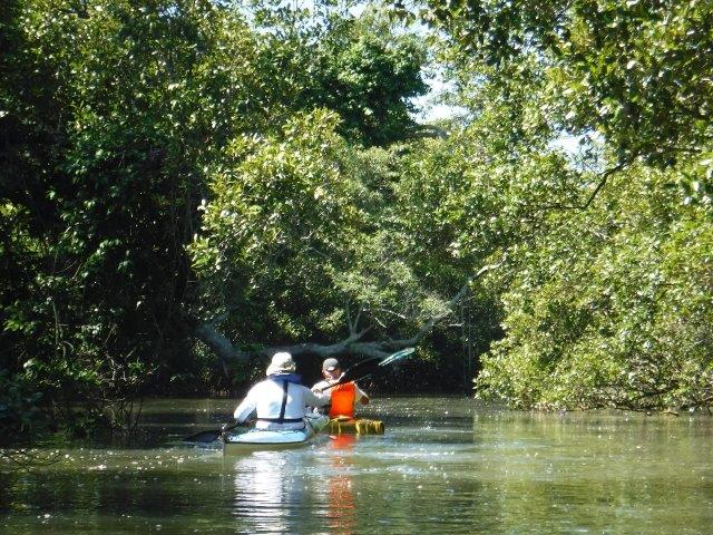
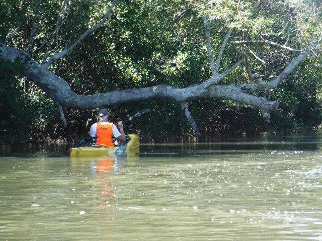
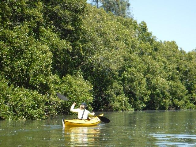
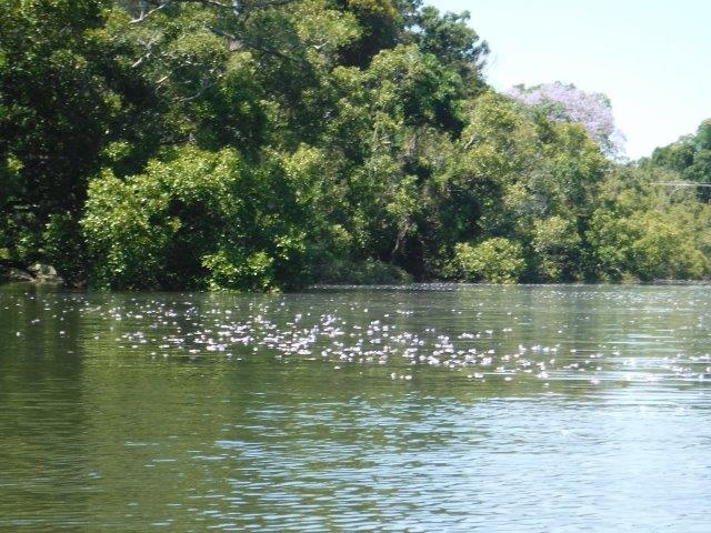
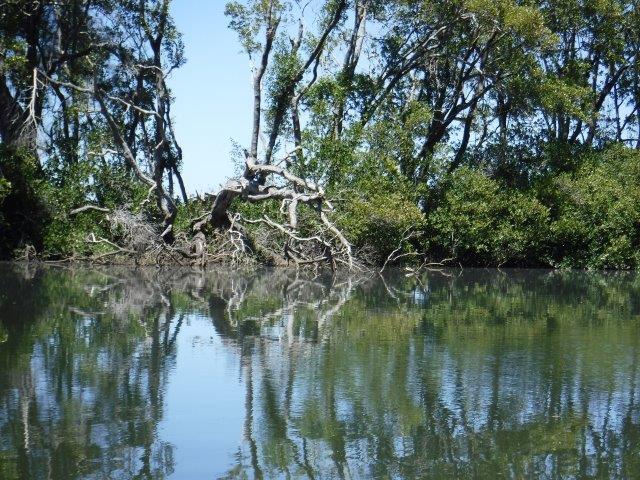
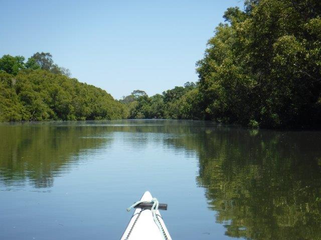
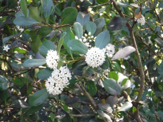
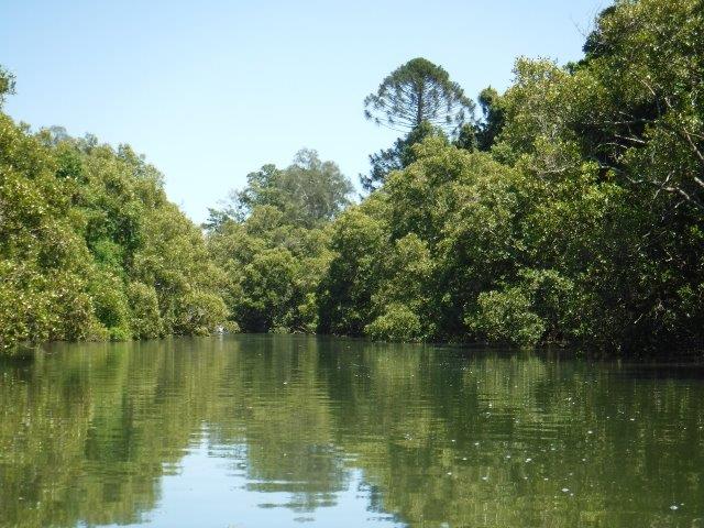
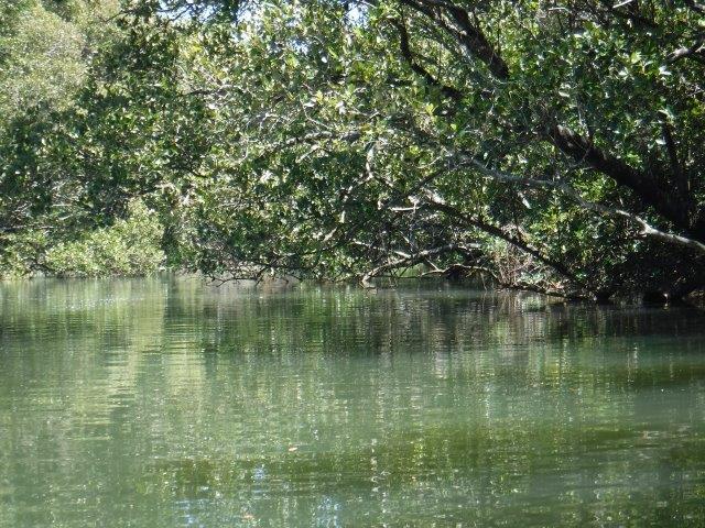
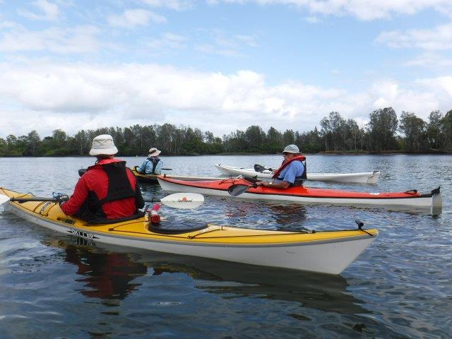
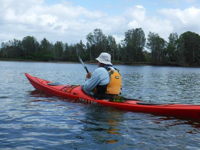
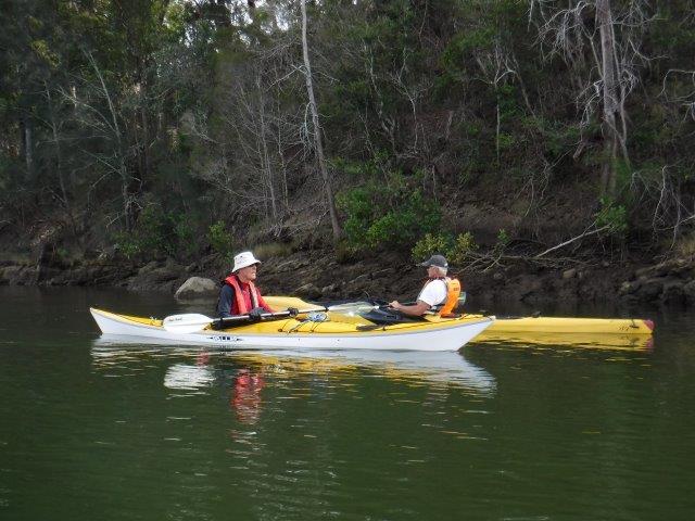
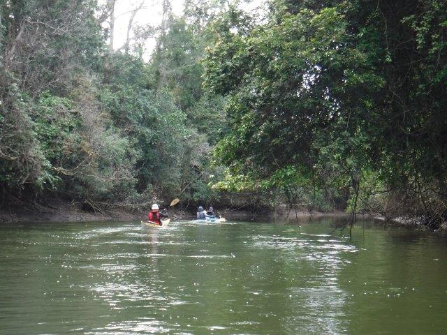
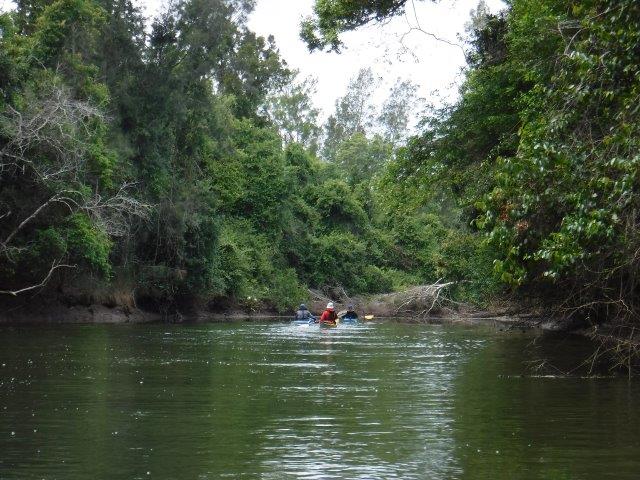
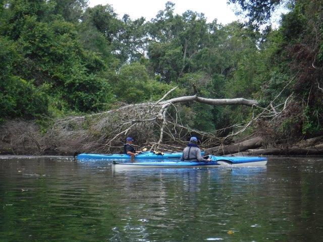
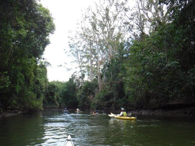
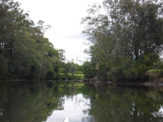
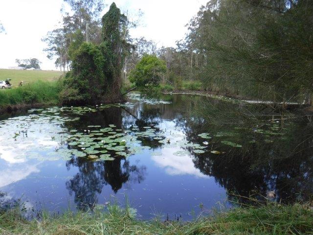
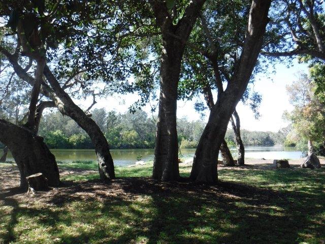
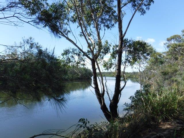
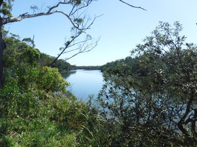
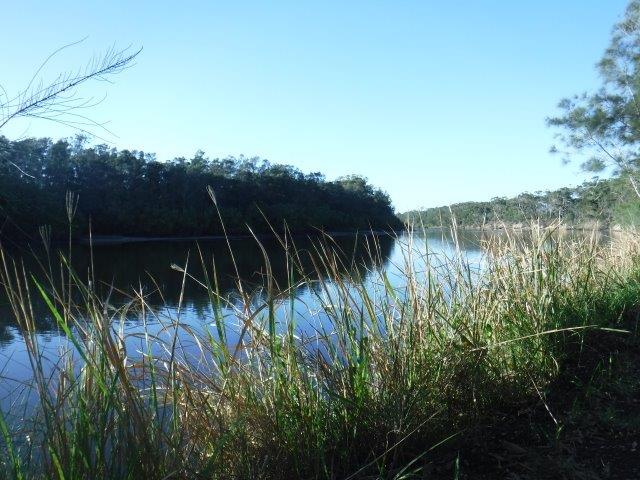
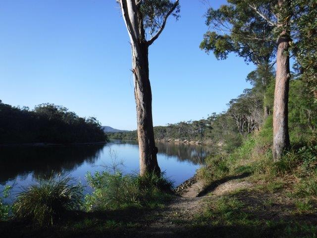
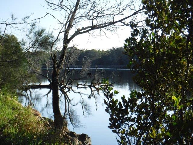
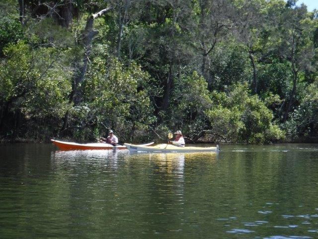
We enjoyed our paddle up the Wilson, particularly the upper reaches above the little grass islands where the river become shallow in places with  smooth river rocks close enough to touch as you glide over them. The banks rise up steeply on the right hand side with glorious straight, white trunked gums soaring up above. It is incredibly picturesque along this stretch & this season the bloodwood trees are flowering in profusion; you could smell their perfume which was sweet & subtle. There are a few more wash away areas that have appeared up this end & our usual spot is still accessible. We had a break here as debris & a strong current in the little race prevented further paddling. 


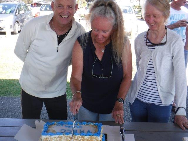
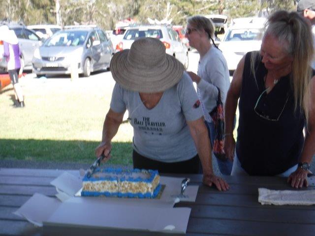
Thanks to everyone who joined us & we hope you enjoyed the paddle.
Cheers
Caroline


**Historical information from Wikipedia, A History of Telegraph Point & Telegraph Point & Surrounds compiled by Port Macquarie Hastings Council.      

Blog

Ghinni Ghinni Creek at Coopernook


No Comments

Hi everyone,


Twelve of us undertook the paddle down Ghinni Ghinni Creek at Coopernook on Sunday 15 November. We split into two groups with some of us going right down & exploring  Dickensons Creek which branches off to the right just shy of The Other Side Café. Without the lure of coffee & decadent cakes devoured in the shady garden of the café, this paddle will never be quite the same!! (The café was a victim of the early COVID shut down, the owner electing not to continue the café side of her business, sadly for us & many others ).


We had an enjoyable paddle on this winding creek flanked by farming land on both sides & tiers of river & grey mangroves which were in full flower. A few stunning jacaranda trees towered above the trees, their mauve crowns glorious against the backdrop of blue sky, while their fallen blossoms floated on the water. The white mangrove flowers smell a bit like privet but not as strong, & set off some sneezing amongst those of us prone to allergies!! 
Ghinni Ghinni means ‘mud crab’ & Coopernook means ‘elbow’ in the local Biripi language. The latter refers to a bend on the Lansdowne River that resembles an elbow in shape. Ghinni Ghinni Creek runs between Jones Island & the mainland & is approx.. 9 kms in length. It has entrances into both the Manning & Lansdowne Rivers. In the early 1900’s, droghers came up the creek to collect casks of tallow & bags of bones & hide. The hides were salted & bagged up. ( Droghers are cargo boats; described as blunt ended & flat bottomed river boats with plenty of deck space they were generally of robust construction & shallow draught making them ideal for rivers & creeks carrying all manner of goods & foodstuffs to isolated hinterland communities & returning with raw materials to be sent to the bigger cities via ships ). The droghers had to arrive & depart from the Coopernook end as they could not pass under the Ghinni Ghinni bridge. To turn, they were pooled around. Their cargo was loaded onto north coast boats at either Coopernook or Croki wharf & taken to the Sydney markets. Local identity of the times, author & poet Henry “Hawkeye” Edwards recorded that in the 1880’s sailing boats went up Ghinni Ghinni Creek picking up corn from farms. A big wooden plank would be put out between the boat & the bank in order to load the corn. ( The north bound bridge over the Manning is named after “Hawkeye” ). Helping out with boats on the creek could be dangerous work. On March 10, 1891, Hawkeye was involved in an accident at the Cundletown steamers wharf. While acting in the capacity as an agent for a company, he was assisting the steamer Rosedale to dock at about 11pm at night. While standing on an old stone jetty, lantern in hand & waiting to catch the rope to secure the vessel to the wharf, he slipped & fell on his head & side & was rendered unconscious. Fortunately one Constable Hogan was present & rescued him. 


The baker, butcher & grocer all plied their wares up & down the creek. The grocer, a Mr. C.L Harris had a boat called the MYRA ( see photo ) fitted out with shelves & housewives could get a wide range of goods & trade their eggs for groceries.


Coopernook was originally a small river port & developed as a result of sawmilling & ship building. Its wharf was one of a number of wharves along the Manning & its tributaries. There is now a monument in its place as most of the original wharf lay submerged in the river in a deteriorated state. It was proclaimed a village in 1890. The old pub was built in 1928 & the Bascule Bridge over the Lansdowne River was constructed in 1933. The bridge was removed as a result of the Pacific Highway upgrade but the tower component was installed on the foreshore in front of the pub for its historical significance. ( A Bascule bridge is essentially  a lifting bridge; it is a moveable bridge with a counter weight that continuously balances on a pan or leaf throughout its upward swing to provide clearance for boat traffic. The word ‘bascule’ is from the French & is a term meaning balance scale.


Five of us paddled up Dickensons Creek which was very pleasant. It is more narrow than Ghinni Ghinni & we got as far up as a log stock crossing. As the tide was still running in, we decided to turn around rather than risk getting caught out on the return paddle.


After our paddle, the day was heating up & it was pleasant to have lunch in the shade overlooking the ramp & foreshore.


Thanks Martin for volunteering to lead the shorter paddle .


Cheers
Caroline

Blog

Sancrox to Sarahs & King Creek


No Comments

 Hi everyone,


Well we had a full contingent for last Sunday’s paddle from Sancrox upriver to Sarahs & King Creek. It was a lovely morning weather wise & thanks to Di’s friends Keith & Liz Charles for allowing us to launch from their property. It is a beautiful spot just before the Rawdon Island Bridge ( coming from Port ) which they had kindly slashed for us. We welcomed Bruce & Lynne back to Sunday paddles & new members Grant, Steve & Kevin ( & Kevin’s daughter Natasha who was visiting).


Due to the numbers, we split into two groups with Stephen & Greg as leaders. At various times when I was taking pictures along the way, the kayaks looked like an Armada advancing up the river. As the tide was low, we got  excellent close ups of where the treacherous rocks are situated under the bridge & up near Narrow Gut. It was pleasant paddling up around the islands before linking up with the main river again, but we did not get far up Sarahs Creek  due to a fallen tree. A few of us paddled on to King Creek & had better luck but did not paddle all the way up. We crossed paths with the second group on the return trip & all made our way back down to Sancrox. Lunch was back at the launch point overlooking the delightful little ‘Monet’ lilypond.


Sancrox is approximately 12 kms west of Port Macquarie. Records from the Mid North Coast Library revealed that surveys of land around Port started in the 1830’s with a view towards opening up land for free settlers.
The survey here commenced in this area in 1831 & the starting point was the south west corner of the township named Hay ( named after Colonial Under-Secretary Robert William Hay ). It was known as Portion 1. There was a plan for a town but it never eventuated & for generations the area was referred to as Haytown or Haytown Reserve. By the end of the 1800’s there was a timber mill, a wharf & a punt across the river to Rawdon Island. The river at the time was impassable past this point for shipping due to a reef of rocks ( the remnants of which you see at low tide ). The area was, in the beginning, variously called St. Croix, St. Rocks & San Roch ( the latter meaning ‘saint on a sunken rock’) & was the site of a government farm run by a Frenchman. The name Sancrox survived all others, possibly as a misuse of the word San Roch, & was gazetted as such when timber mill workers cottages stood thereabouts. Eventually, the rocks were blasted through, the river dredged & from 1835 onwards ships were able to travel up as far as where Bain Bridge now spans the river.


Sarahs Creek flows from Cowarra Forest & is named after Sarah Allman ( wife of Captain Francis Allman, Commandant & Magistrate of Port Macquarie ) & her first child. Sarahs Creek Bridge was built in 1886 & is purportedly named after one Sarah Suters, wife of local farmer James Suters. 


Thanks to everyone who turned out to support this paddle & to Stephen & Greg for leading.


Hope everyone enjoyed their morning on the water

Cheers Caroline

Blog

Gumma


No Comments

Hi everyone,


It was great that we had 15 people on our paddle up at Gumma, despite the windy & stormy weather conditions that were hanging around. Most had not been here before which made it even better. As it turned out, Sunday morning brought perfect conditions to showcase this beautiful area, in this instance the section from Gumma up Warrell Creek to Scotts Head. We also had five visitors….Ken B on his motorcycle & Richard & Maria with their dog Florence ( who did the meet, greet & splash at Scotts Head ) & Ray & Bev  their dog Holly.


We have camped & paddled on many occasions up at Gumma, the camping ground on the banks of Warrell Creek at Macksville, and the timeless beauty of the area never fails to impress.


Gumma, ( aka Boultons Crossing ) is part of the Gaagal Wanggaan/South Beach National Park & is jointly managed by the NSW National Parks & Wildlife Service & Aboriginal Traditional Owners. The area holds tremendous significance for the Gumbaynggirr people as sites within the park demonstrate continuous use for thousands of years. The area was used as a source of food & for ritual practices & it is still in use today.
Warrell Creek has a tidal limit of approx.. 30kms upstream to near the village of Upper Warrell Creek ( I have included a photo I took some years ago from a lookout at Nambucca looking up the creek from its mouth where the creek meets the Nambucca River at the ocean ). The creek has 32.22ha of mangroves which accounts for 22.6% of the total mangroves in Nambucca. Three kinds of mangroves grow in the Warrell Creek environs;  grey, river &milky, the sap of the latter being poisonous & able to cause temporary blindness if it comes in contact with the eyes. The Aboriginal people used mangrove wood to make shields. The creek has 31.47ha of saltmarsh which accounts for 24.68% of the total saltmarsh in Nambucca. Saltmarshes are habitats for herbs, reeds, sedges & shrubs which can tolerate high soil salinity & occasional saltwater inundation. 


The paddle up to Scotts Head is one of the most beautiful paddles you could do. Clear water, little bays, sand dunes, views towards Yarahappini & lovely tree lined banks of banksia, blackbutt, scribbly gum & a rich & varied undergrowth of shrubs & grasses & cabbage palms. Bird life is abundant & we saw waders & a white bellied sea eagle. There is a protected nesting area closer to the mouth for the little terns. When we reached Scotts Head our day visitors welcomed us, especially Florence, who leapt over kayaks meeting & greeting & enjoying splashing about in the shallows. 


On the road towards Gumma is the Mary Boulton Pioneer Cottage. The late Miss Mary Boulton lived & worked in the area all her life. Her grandfather had the first hotel in the area, near where the cottage is located. She decided to develop a replica pioneer cottage after seeing a similar concept in the US. It opened in 1970 & is constructed from century old recycled timber slabs. In 1999 she donated the whole complex to the Nambucca Valley Council. She died in 2003. Information from an Aboriginal Elder, Tiger Buchanan, indicates that the word’ Gumma’ derives from the Aboriginal word’ Gumming’ meaning ‘red clay’. Local historians have indicated that  Red Hill, where members of the Boulton family still reside, consisted of red volcanic clay & was where indigenous people crossed to make their way to a bora ring on Bald Hill. ( Bora rings are ceremonial grounds, generally a raised platform of dirt arranged in a circle ).


There are many paddles (  most of which we have explored over the years ) you can do up here, not only on Warrell Creek but on the two arms of the Nambucca River. The highway upgrade has made it a drive of just over an hour to Macksville so we may schedule more paddles in this beautiful part of the world in the future.
Hope everyone enjoyed their paddle & thanks for joining us.


Cheers
Caroline & Bill


Blog

PMHCC 13th Anniversary


No Comments

Happy 13th anniversary Port Macquarie Hastings Canoe Club Inc!

Last Thursday we celebrated this landmark with a lovely cake ( thanks Greg for organising this ) after our paddle.

Hard to believe it was that long ago that we had a public meeting in the outdoor bbq room at Hibbard Sports Club to discuss interest in forming a canoe club in Port Macquarie. A lot has happened since then & we have a solid membership base thanks to the hard work of our various committees & dedicated members over the years. We have paddled lots of beautiful creeks & rivers, made good friendships, enjoyed good times & shared sad times.

Thanks everyone for your ongoing support.

Keep paddling
The Committee, PMHCC INC